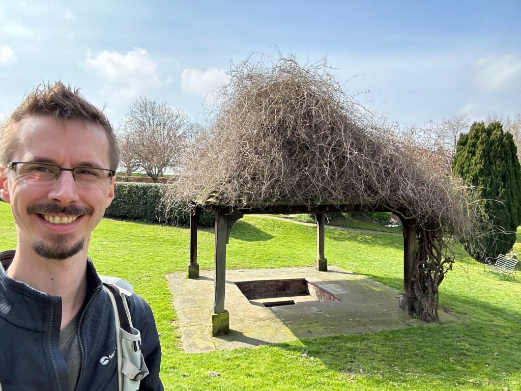
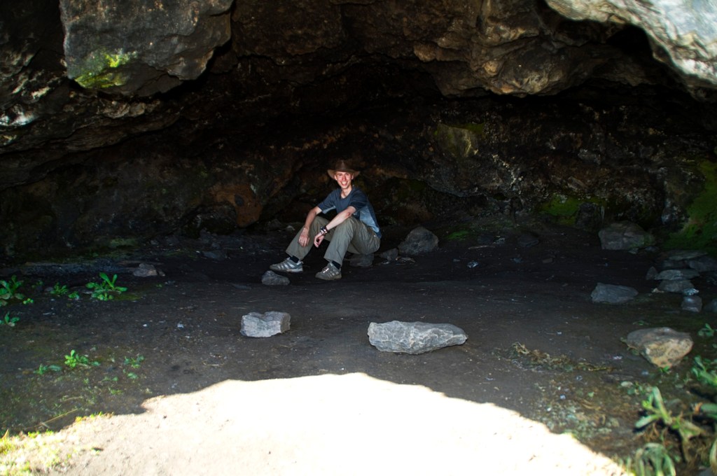
I arrived into Lichfield early afternoon on this glorious sunny spring day. I took a stroll to St. Chads to have a look around while it was nice. I leafed through the visitor book and it seems I’m the first to make an entry this year stating I’m beginning the Two Saints Way.
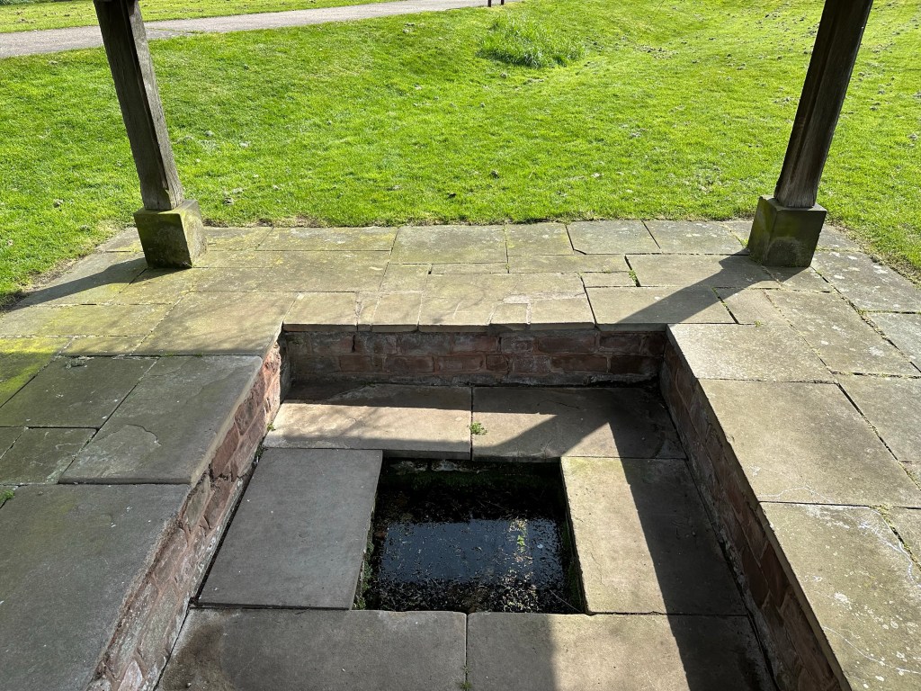
I found St. Chads infamous well and thought of dipping my feet in, however the water didn’t look too inviting.
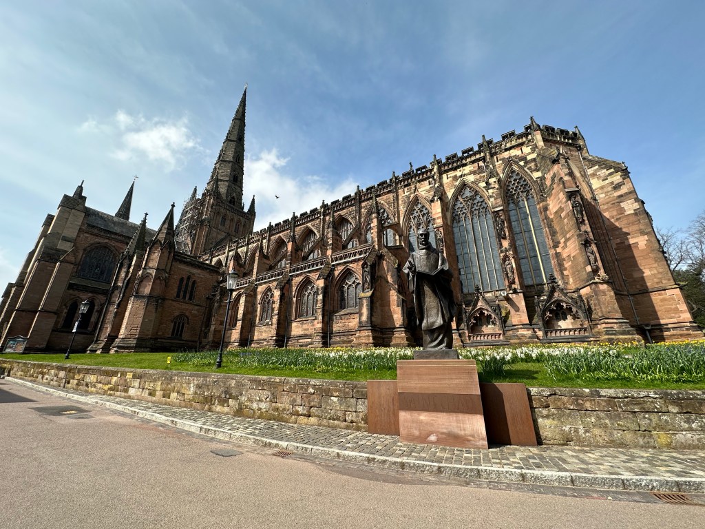
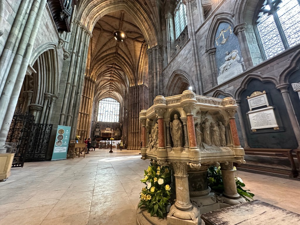
I then followed the banks of a small lake to the cathedral where I saw the man himself. The masonry work in the red sandstone to this gothic style building is exquisite.
Apparently the cathedral is one of only three in England that has three spires and the only one of the three that is medieval.
Being Easter Sunday, the city is very quiet enabling me to enjoy the sights with no crowds. Along the walls are stone sculptures, tall stained glass windows and an elaborately decorated font.
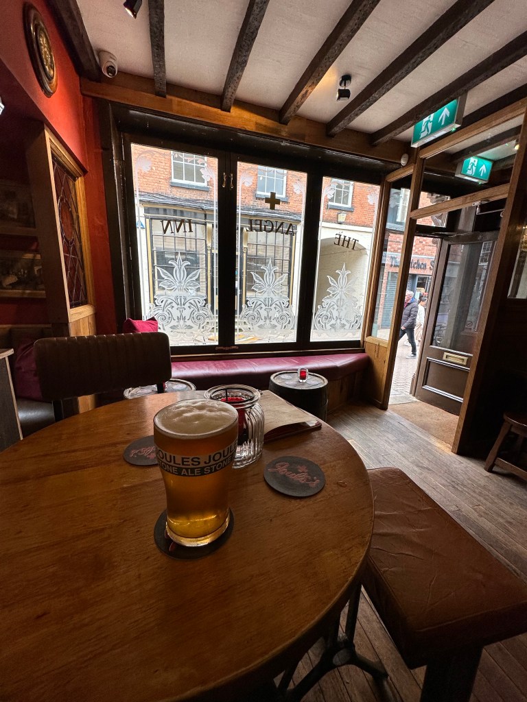
I had look around the centre, (which is very small for a city) to grab a bite to eat, followed by a quick pint at the king’s head before check-in at my lodgings for the night.
I dumped my bag in my room and changed into my ‘town’ shirt, ready to search for another watering hole and scout out somewhere for dinner. (Got to get the calories in ready for tomorrow – well that’s my excuse)
With only a week to go, I’m getting prepared and very much looking forward to my first through hike of the year. I’ve even ordered some new walking trousers! I’ve given my boots a good clean and waterproofing, and my rucksack is all packed and ready. I’ve plotted my routes on the Ordnance Survey App and booked my train ticket to Lichfield. I’m all set!
I’ll post a daily blog of my journey as usual, however, I’m going to dabble in the Instagram for this trip. I’ve never used this platform and after some convincing from my brother, he has assured me it will be a good thing. I’m not sure how my foray with this social media app will pan out, but I’m sure I’ll be able to stumble my way through it.
The gear I am taking is pretty much what I took on the Camino Portugués which can be found here. I’ll be going in my trusty Scarpa Mistral GTX rather than my trail runners; the UK weather has been very unpredictable as of late.
The trousers I’ve gone for, is a pair of Revolution Race Nordwand Trousers. A brand I have never heard of, but thought I’d take a plunge as these had good reviews.
Although on first impressions they are a bit pricey for the quality, but I haven’t tried them out in anger yet. I think I will swap out my poncho for a waterproof jacket and trousers, just for the convenience while in the towns, but I haven’t decided yet, and probably make the decision as I leave my front door!
According to the maps, the first day will be the hilliest and although the last two are long, it is mostly along canals. I should be ok and as I’m setting off on in April unlike I did for the Cotswold Way, there will be more daylight to play with, and I won’t find myself in a situation where I’m some distance from the stage end and losing the light! (Unless I get waylaid by a nice pub or two)
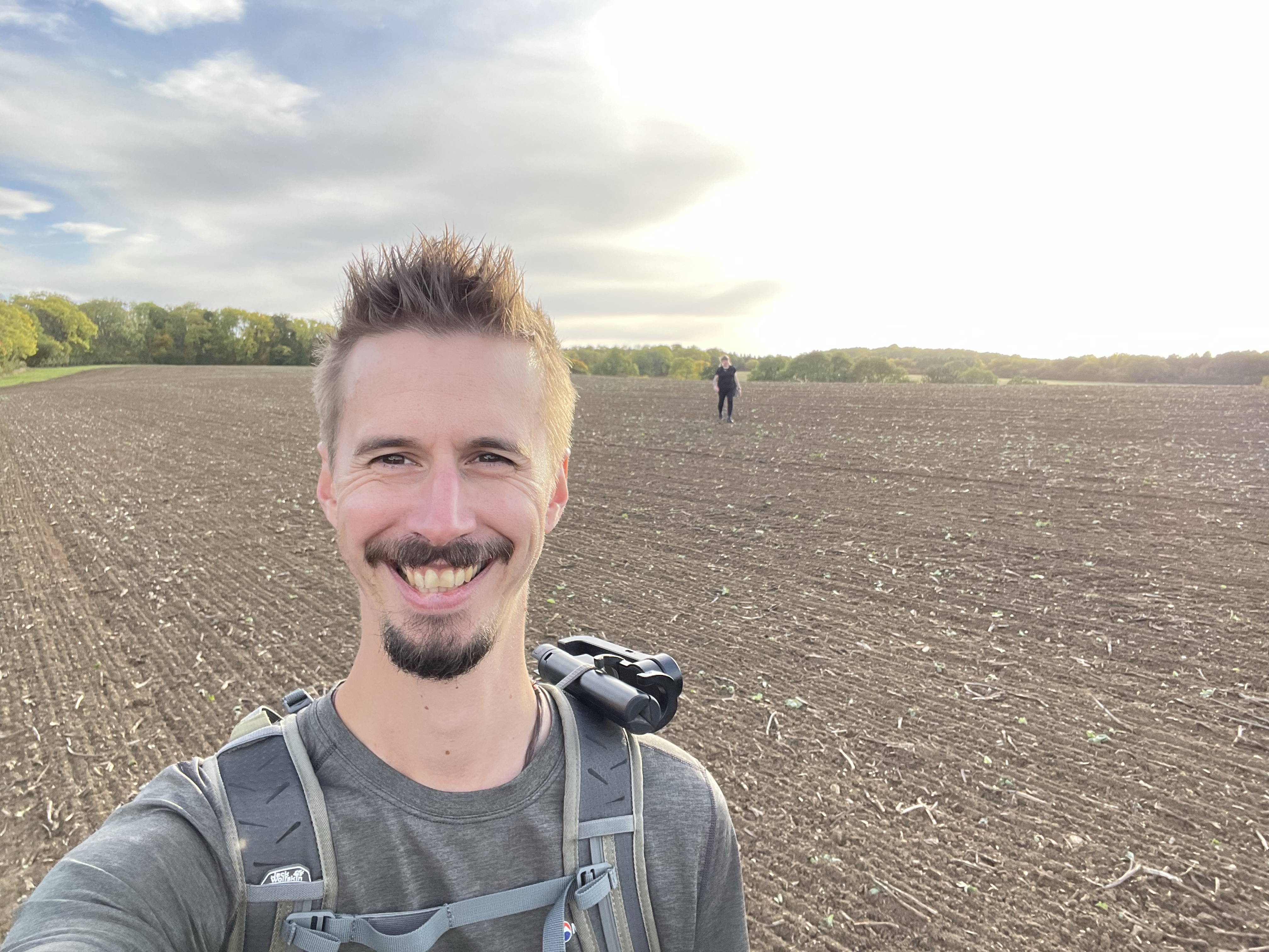
I’ll be arriving in Lichfield Sunday afternoon and spending the night there before beginning The Way of St. Werburgh Monday morning. Can’t wait!
Here is part two on the figures for the Two Saints Way. The Way of St. Chad goes in the opposite direction to St. Werburgh, starting in Chester. Like St. Werburgh, he too was active in the 7th century however unlike our goose loving saint, he came from a Celtic Christian background.
St. Chad was born in Northumbria to a wealthy family and spent his early adulthood on Lindisfarne becoming one of St. Aidan’s disciples. He spent time travelling in Ireland where St. Aidan was originally from. While abroad, his older brother Cedd, a well known figure in the church for his missionary work in East Anglia, had established a monastery at Lastingham in Yorkshire.
However in 664AD he died from the plague, but before he passed away, he had appointed St. Chad to take over his position. During his time at the monastery he gained a reputation for kindness and hospitality. Meanwhile another important figure of the time, St. Wilfred, was to become the Bishop of York and had left Britain to be ordained in France. (Britain at the time was considered too pagan for ordination to be officially stamped by the Catholic Church – I guess we have always been an uncouth lot!).
The King of Northumbira grew impatient with the lack of religious guidance and ordered St. Chad to Kent to be ordained as the Bishop of the Northern Church at York. He took to the task enthusiastically, and while traveling he would refuse to go by horseback, but instead walk. (You can see why I like this guy!)
However on St. Wilfred’s return it all got a bit political. He wasn’t happy St. Chad was ordained and the Bishop of Canterbury charged him of illegally holding his office. Not one for politics and power, St. Chad had only taken up the post out of a sense of duty and didn’t consider himself worthy of the position; he was happy to step down and return to Lastingham.
The Bishop of Canterbury was so touched by his humility and officially ordain him. In 669AD he was called to be the Bishop of Mercia, bringing him to the Midlands, specifically Lichfield. He is reputed to have performed baptisms at the well in St. Chad’s Church within the city, where he would spend hours praying while standing in its waters!
He died in 672AD and was venerated as a saint; a marble shrine adorned with precious stones and gold was commissioned to house his remains. During the reformation, the shrine was taken down and his bones were hidden over the centuries by Catholic families living in Staffordshire. Some were discovered at Aston Hall; these are now held in Birmingham Cathedral.
No fables involving fowl this time, but he is a fellow long distance walker and probably the reason why he spent such a long time standing in a well! He’s a fitting character for this through hike and I can’t wait to start (I wonder if there is a well to dip my feet in at Chester?!)
Another week closer to my first through hike of the year, and here is one of two posts giving some background on the Saints this pilgrimage is named after.
You probably have never heard of St. Werburgh and why her shrine is the destination for pilgrims. So here is a TLDR synopsis.
St. Werburgh had great influence in the 7th century for the spread of Christianity through the kingdom of ‘Mercia’, which covered the entire midlands, south of the the river Dee and Humber and north of the Avon and Thames.
She was the daughter to the Mercian King Wulphere. It is believed she was born at ‘Bury Bank’ outside the village of ’Stone’ in Staffordshire.
She entered a convent at the Abbey of Ely where her aunt was the Abbess. She adopted the modest life of a nun, giving up the luxuries of royalty.
She eventually became responsible for the all the convents in Mercia, and through the wealth of her family, she established numerous convents throughout the kingdom that became models of the monastic lifestyle.
She had founded a monastery in Weedon, a village that is a stones throw from me! Before her death she visited all her convents and was buried in Repton. However, she was re-interred due to the invading vikings, at St. Peter and St. Paul’s Church, which is now Chester Cathedral.
The goose that has become associated with St. Werburgh, originates from a story about the Weedon convent. A flock of wild geese ravaged farmland belonging to her, and as a punishment she locked them up indoors overnight; however she pardoned them the following morning and released them from captivity.
During the night a servant had stolen one; the flock realising they were one down, noisily pestered St. Werburgh. Grasping the meaning of the racket, she tracked down the servant to secure the release of the bird.
The flock then flew away, never to return and interfere with convent or it’s lands again.
Whether it is on a long journey like the Camino or a short walk like the Two Saints Way, there are such fables like this, that add a bit of culture to the walks.
It is becoming a theme with me; three-four months after a through hike/Camino, my legs get restless and pine for another long distance walk. This happened leading up to the Cotswold Way and it is now happening again.
I’ve been toying with different ideas for through hikes, and I had settled on walking the entire coast of the ‘Isle of Wight’; a small island off the south coast of England.
However, having worked out the logistics and costings, it would be cheaper to go back to Spain and walk a shorter route, such as the Camino Inglés.
A family member recently visited Chester and spotted the scallop shell on a signpost, that as you know, is the symbol for the Camino. After a bit of research, it turns out there is a pilgrimage between the cathedrals in Lichfield and Chester. It is called the ‘Two Saints Way’.
My Camino obsession had been tingled, and so I went into full research mode. Disappointingly there is very little on YouTube, which is usually a good starting point and the websites around this route are a bit clunky and not very helpful, especially regarding accommodation.
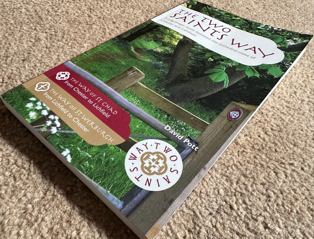
Next stop was Amazon to see if there are any books/guides. Luckily there is: The Two Saints Way by David Pott.
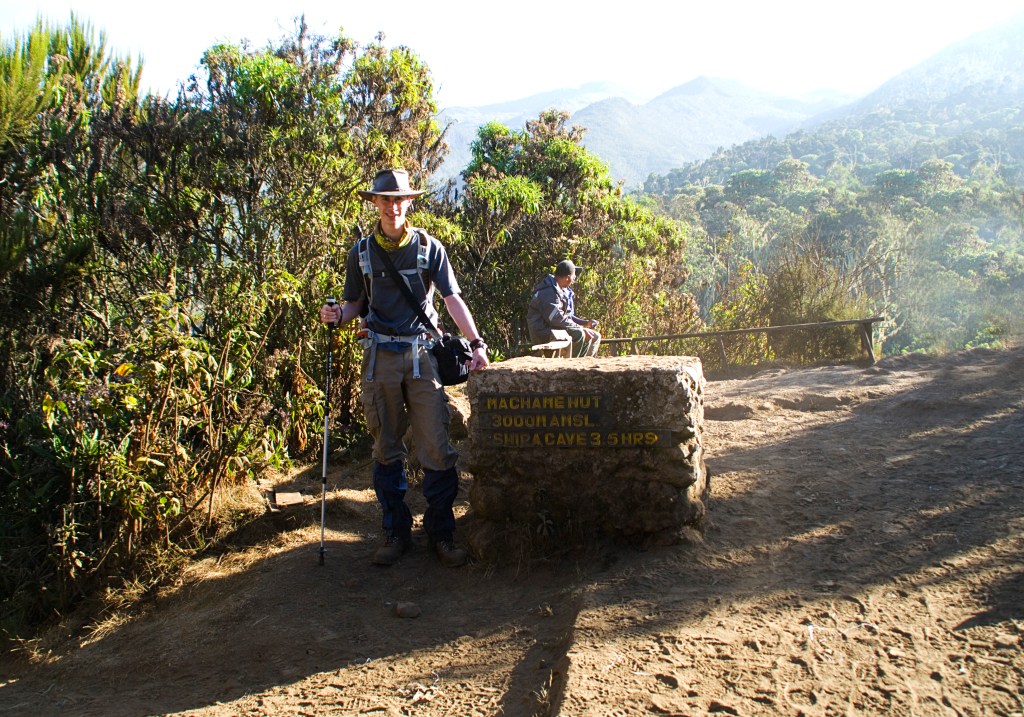
Depending on which city you would like to start in, determines the route. I’m planning to start in Lichfield following ‘The Way of St. Werburgh’, which is marked by picture of a goose, a bird that became synonymous with Saint.
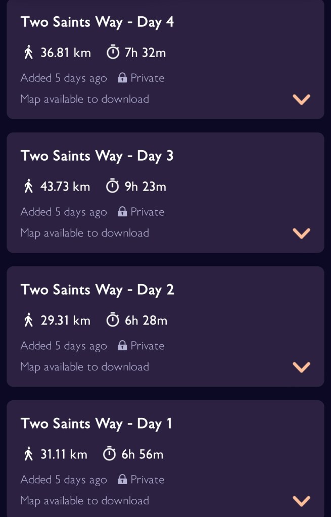
The guide recommends undertaking the pilgrimage over seven days, however some of those days are very short and you know me by now, I’m a glutton for punishment; I’m going to walk it in four.
The stages will be:
Lichfield to Stafford (20 miles)
Stafford to Stoke-on-Trent (23 miles)
Stoke-on-Tent to Nantwich (25.5 miles)
Nantwich to Chester (23.5 miles)
92 miles! I’ll be stopping at BnBs and one night with family in Stoke. I’m forgoing the tent this time so I can cover the distances at a quicker pace; also means I’ll be using my Camino gear which I’m accustomed to carrying.
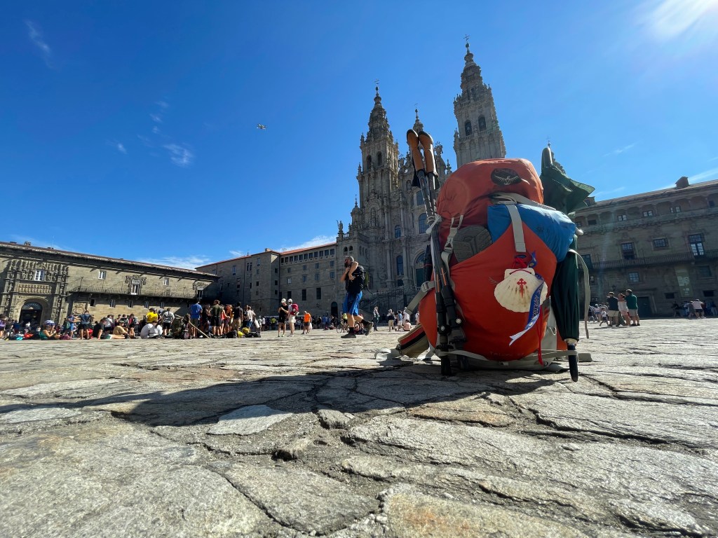
Five weeks from now I’ll be donning my pack, tying my laces and walking my first through hike of the year; a little bit of practice before my return to Sarria on the Camino Frances, in September.
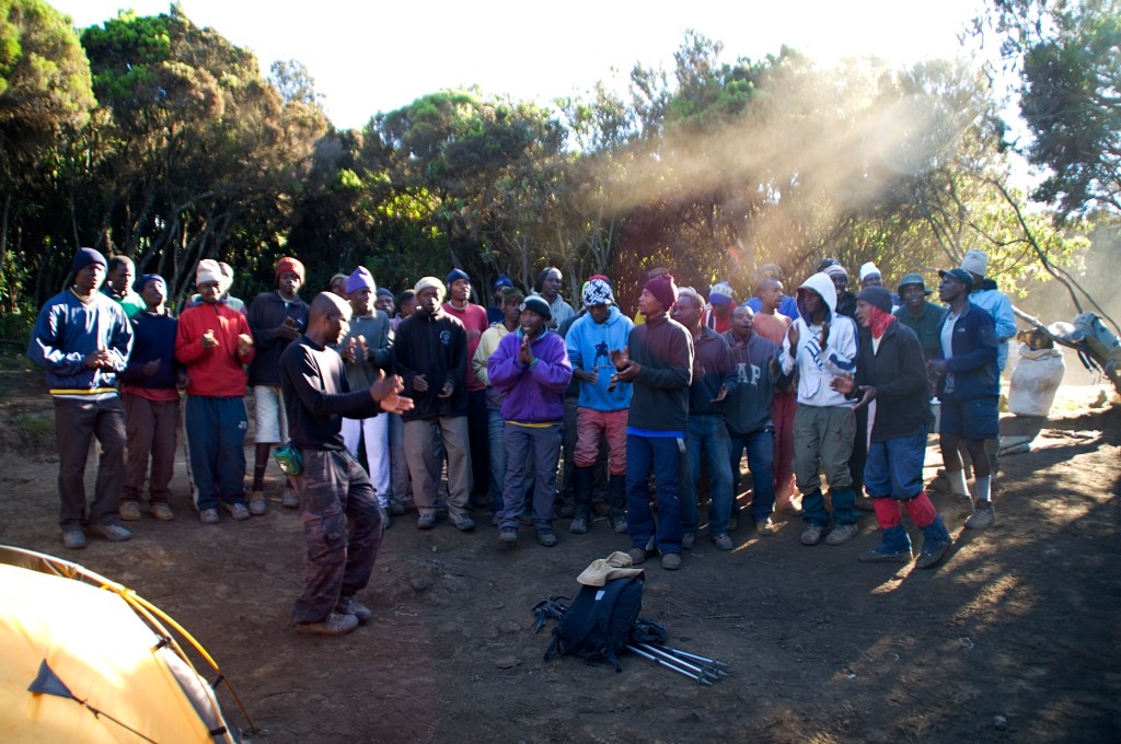
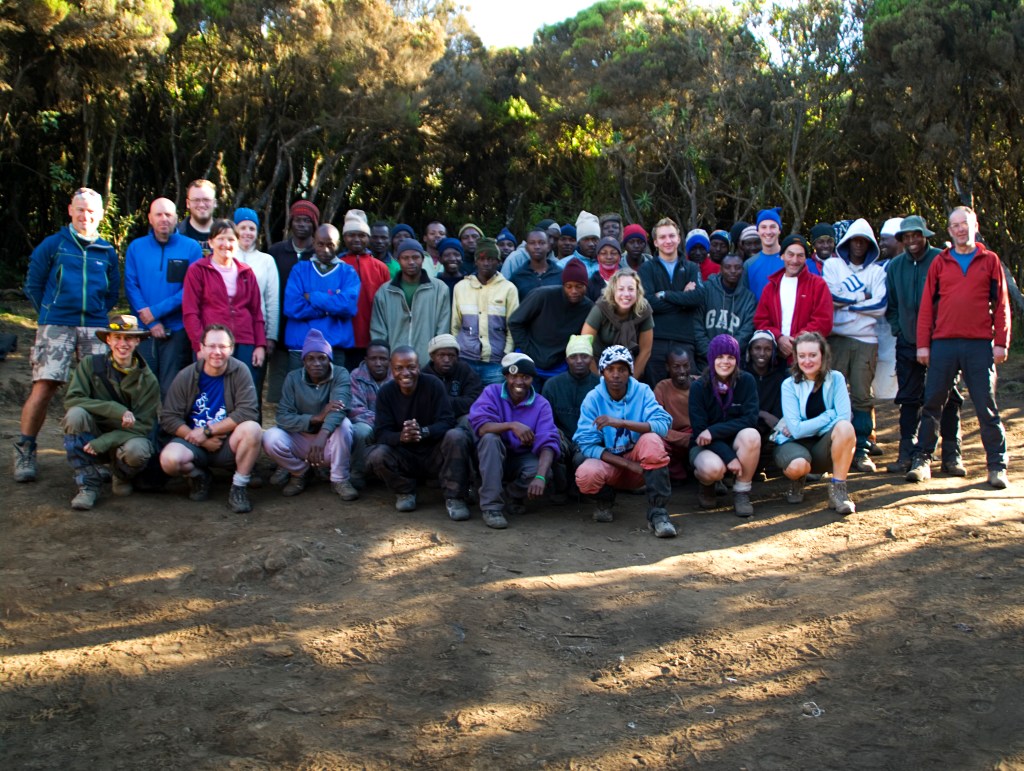
It was an early start and my appetite had returned however worrying I still hadn’t had a movement, those Imodium tablets are super effective! After breakfast we all had a group photograph with the porters and they performed a song for us.
The group had all put in money for tips and shared them out to the porters and cooks. I then gave some extra dollars to Moses as a personal thank you. The porters would be taking our gear to the coach and then making their way the ‘Machame Gate’ to start their services with a new group undertaking Kilimanjaro.
The walk to Mweka gate was very pleasant, passing through the jungle, listening to the birds chirping and spying the monkeys in the canopy. After signing out of the national park we walked to ‘Mweka’ village passing through farms with children waving and watching us walk by.
We stopped at a café to have dinner of banana stew, which didn’t taste like I expected. We said bye to our guides giving them some gifts. I had some unused thermals that I handed out. We left to board the coach to be greeted by the children from the village, we decided to hand out sweets and other snacks we still had left in our packs.
I watched the country fly by as we made our way back to ‘Arusha’. It was bittersweet that the climb was over. I enjoyed the whole experience and certainly had plenty of stories to tell on my return home, but I was tired. As soon as I got to my hut at the same hotel I stopped at on the first night, I jumped into the shower.
Once feeling civilised again, I went to the hotel bar where I had a few drinks with Tim (the group member who had to return due to the chest infection). He was recovering well and had colour back in his cheeks; he had been prescribed a course of anti-biotics. After resting up for a day, he went on a safari in the Serengeti and explored Arusha thus made the most of his time in Tanzania.
After dinner, some of the group went into Arusha with William to hit a few clubs, however I was too exhausted and remained at the hotel bar for a couple more beers, then retired to bed. I fell asleep to the bush babies squawking into the night.
A magical end to my Kilimanjaro adventure.
Postscript
For those who maybe interested about my stomach issues. Despite not having another Imodium since the start of the final ascent, I still hadn’t had a bowel movement. When it finally did, it was somewhere over north Africa. It was a new low; an airplane toilet is one of the worst places to have to take a dump, and the walk of shame back to your seat made me wish I had a parachute so I could jump out the nearest hatch!
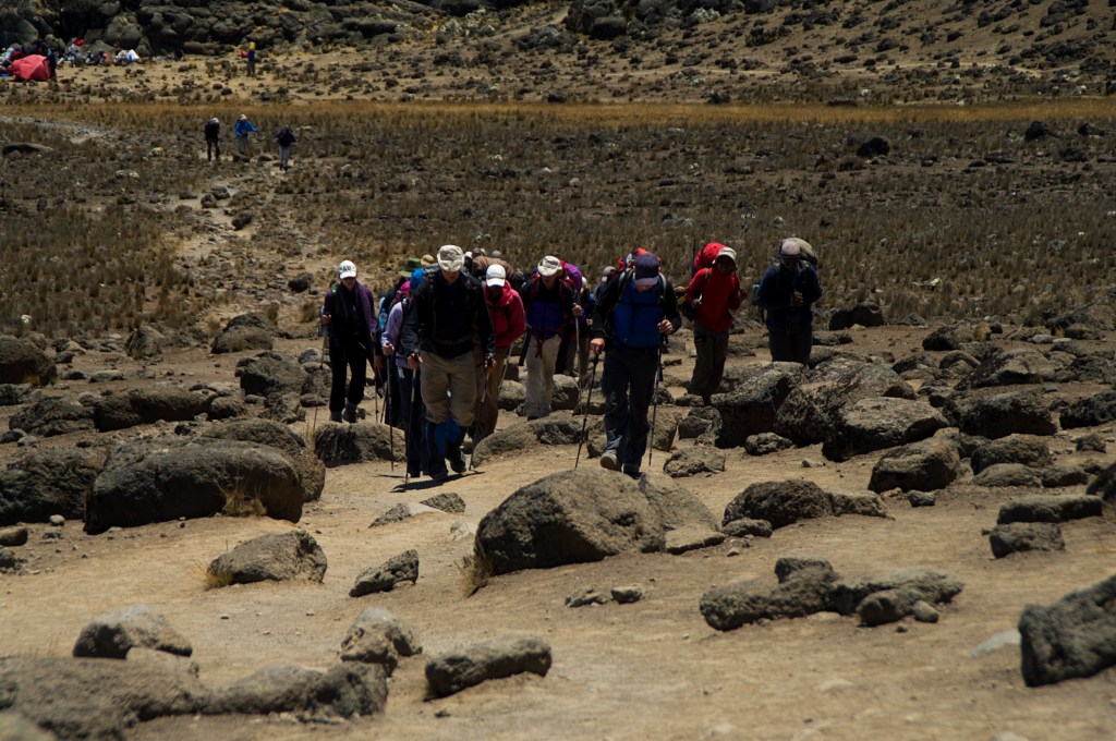
My phone alarm woke me at 1130pm giving me time to get sorted for the midnight start (I took another of Tronel’s Imodium). It was pitch black, no light at all, and William was right, it was cold! -15 Celsius! I couldn’t wait to start moving to warm up. Other groups had already set off, noticeable by the line of torches, snaking up the mountain.
Armed with only our headtorches we began our ascent. It was very hard work and laborious. The path consisted of frozen scree, which is the reason for starting so early. With the ground frozen it made the footing more secure and easier to traverse. I had my head down concentrating on my foot placement, maintaining a constant pace and controlling my breathing.
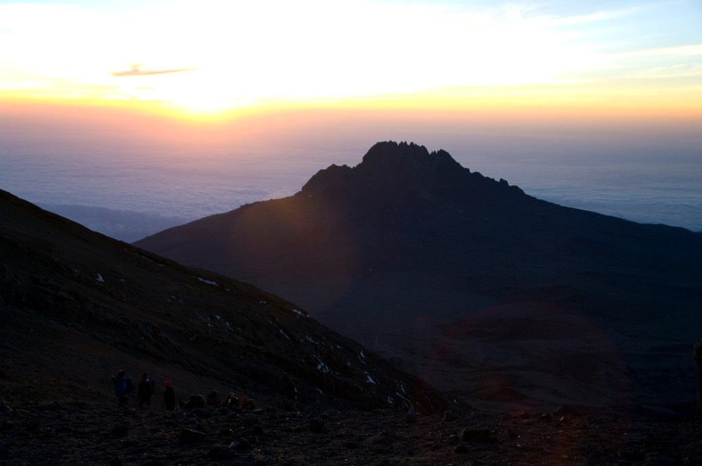
Hours later, climbing the devilish zig-zag path, at dawn I reached ‘Stella Point’, one of the principal peaks of Kilimanjaro. The hard work had been done. From here, the route follows the rim of the volcanic crater to ‘Uhuru Peak’, the summit.
Looking Back from Stella Point
I could only walk a few paces before getting short of breath, the wind was bitterly cold sapping my energy. I was getting frustrated at my seemingly slow progress and at one point I had lost my patience and exasperating out loud, “Enough!” I picked up the pace to get it over with, only to cover a pitiful 10m before almost keeling over gasping for air, much to the amusement of Jeremy.
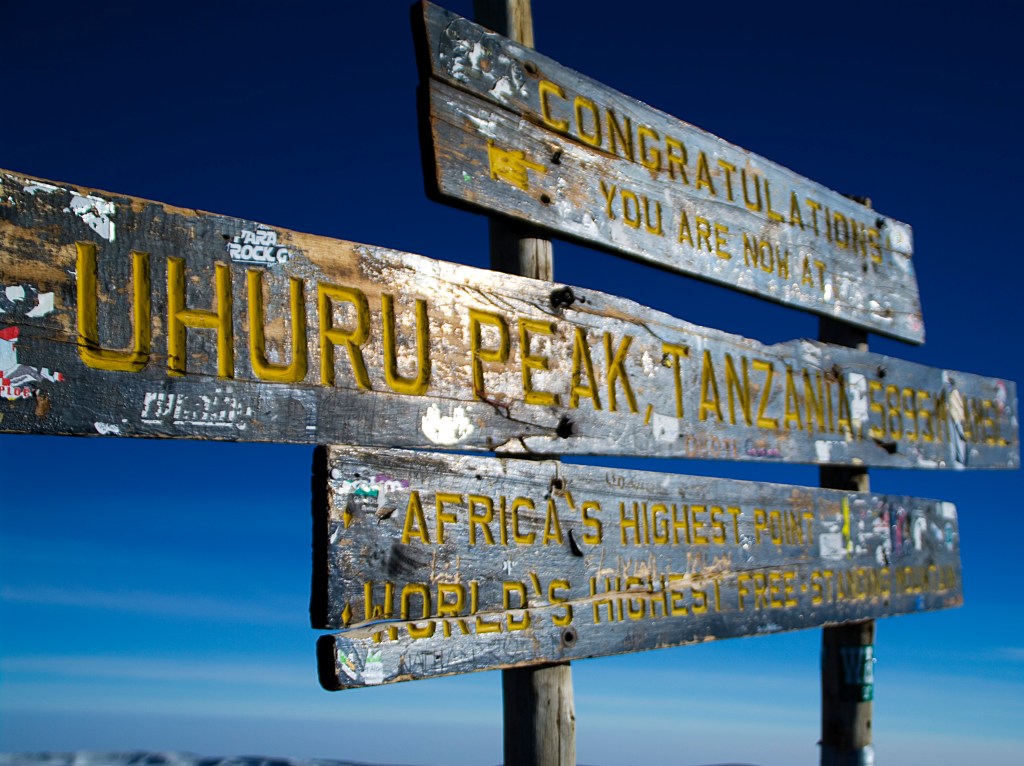
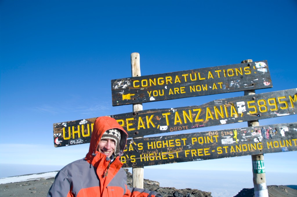
The landscape appeared so barren, alien and inhospitable. I was in awe with the view and experience. I persevered making it to ‘Uhuru Peak’ arriving at 8am. I made it to the roof of Africa!!!
I was one of the first from the group to reach the summit and I waited for the rest to join me. There was a queue at the summit with other groups taking pictures. We all waited patiently for our turn before assembling below the sign, that’s when I noticed there was one missing. Harry hadn’t made it.
Once we had the group photo, I wanted one of just me and the sign. However, at this point there was an inconsiderate and impatient climber who made a snide comment at me. Scowling at me, she said to me “Come on, there are other people wanting pictures!”.
This angered me; we had all waited patiently for others to get their pictures, and it was our turn. The summit wasn’t going anywhere! She could have just chilled out for a bit and savor the moment, and after all it was a great experience, and certainly wasn’t exclusive to her; but instead she decided to throw a bad comment at me. I couldn’t believe how antagonizing and selfish she was; I hoped she would step on Lego when she returned home! Because of her whining at me, I wasn’t concentrating on the person taking the picture, thus I was unable to direct him on how I wanted the image. The result was a composition I wasn’t fully happy with.
Kili Done
The descent back to camp was just as difficult but in a different way; the scree that was frozen only hours ago, had now thawed. Every foot placement slid a few inches down making it a challenging balancing act. I had a few moments resembling Bambi’s first steps and almost ending up on my back! The dust was something else, I was covered in it from head to toe; when I took a drink from my water pipe, it was like taking a mouth full of sand.
It was in my eyes and nose, bypassing my snood. I reached the camp to be greeted by my porter Moses, who cheered and congratulated me. His big beaming smile was a welcoming sight after the unrelenting summit of the tallest free standing mountain in the world.
I relaxed in my tent to update my journal before heading out to find Harry to see if he was ok. I found him with a sullen face, clearly disappointed for not reaching the roof of Africa. Turns out just before ‘Stella Point’, he was struggling to breathe, his head was pounding and feeling dizzy. After informing William, it was decided he needed to descend back to camp.
I sat with him for a while just chatting until Jeremy returned and I passed the baton to him. Soon it was time for lunch, however my stomach wasn’t up to much and I only had an appetite for a less than half of my bread roll and soup.
Shortly after midday we began our descent to Mweka Hut where we would be spending our last night camping on Kilimanjaro. It was exhausting work as by this point, we had been walking the better part of 17 hours. There was no respite from the dust and my left eye was irritating something fierce due to it.
The dusty alpine clime eventually gave way to jungle as we approached camp at 3100m. My tent never had been so welcoming on this entire trip. I soon fell asleep with a smile on my face. One of the 7 conquered!
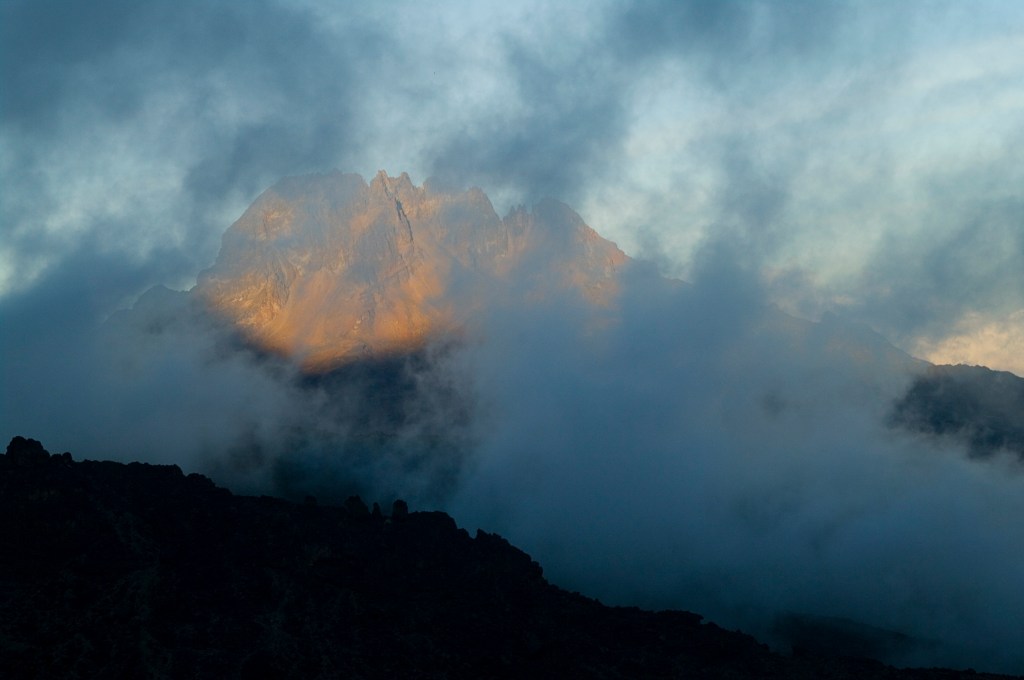
The clouds and mist had dispersed during the night and when I emerged from the tent, I realised we had camped at the base of the ‘Barranco Wall’. It was a nice surprise yet daunting to see that I had to climb this almost shear rock face. It did look menacing.
I woke with a bit of wind, but this was alleviated with a stop to the long drop. After a bowl of porridge, we began our ascent of this lava rock fortress. The ascent is 300m to the top and calling it steep was an understatement.
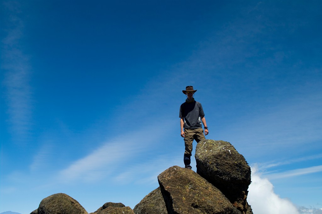
It was tricky to climb, I had to ensure my hand grip was secure and my foot hold was strong to propel myself up the rock face; it was slightly beyond scrambling but not full-on rock climbing. It was challenge but so much fun, I was having the time of my life! Once I reached the top, I was ecstatic, I felt good and strong. The summit would be no problem!
The views were amazing, and it was here I got the ‘picture of the adventure’. With the help of Graham, I posed on top of the wall looking out over the clouds at Mt. Meru. I know it is a little egotistical, but I got this picture printed out onto an Aluminium sheet and it is currently hanging in my Kitchen, I’ve never looked more like an adventurer in this picture, than ever in my life!
Poser
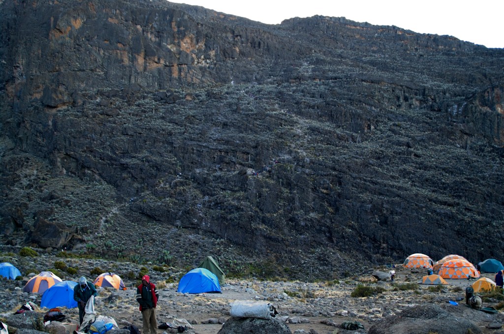
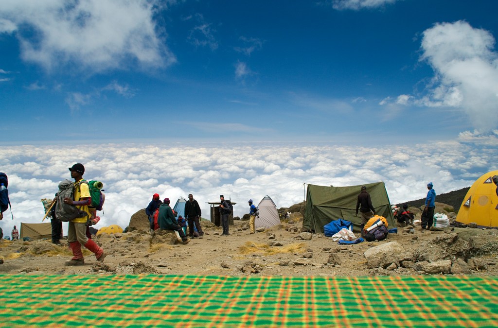
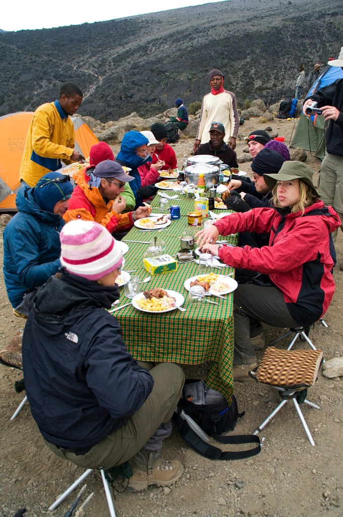
After a short break on the wall, we continued to Karanga Hut (4100m) where we stopped for lunch. It was the most surreal lunch I have ever had to date. The porters had laid out the tables, again complete with tablecloths, outdoors with the views above the clouds.
We were served chicken and chips, very civilised; it couldn’t have been more British even if they erected the Union Jack! I couldn’t believe it, I was dining at 4100m, way above the cloud level. There were smiles and disbelief over everyone’s faces as we tucked into our food.
Alfresco Dining at its FinestTronel Not Too Happy I Snapped this!
What was even more surreal, was I turned on my mobile phone and it pinged with messages. I had signal!!!! I couldn’t resist but had to share the moment and I phoned my dad. How unreal, I was able to speak to home 4100m above sea-level, eating Chicken and Chips at a dining table on the side of Kilimanjaro! (For those fiscal natured readers, I had an international roam deal with my phone company, so the call cost me no more than a £2 – I know, amazing for 2010!)
I sent my love home before heading on towards our next camp at ‘Barafu Hut’. The clouds started to come in and envelope us, dropping the temperature. My stomach started to rumble, and I again had wind, to the point it was becoming very uncomfortable.
We all stopped for a water break and my guts were screaming. I threw down my bag, grabbed my toilet roll and raced to the nearest rock (there are no convenient bushes at this height). I ducked behind it knowing I’m out of view from my group. I drop my kegs down to my ankles and leaning against the rock, I offloaded the package to much relief.
It was at this point I look up to find the path I had just ascended snaked below, where another group was making their way up. I was mortified! But, when you got to go, you got to go! It was some comfort that, I was probably too far for the group below to be able to identify me, and if they did, it’s highly improbable I would meet them ever gain once I returned home.
Yeah, I had gone from one of my life’s highest points to its lowest in a space of 2-3 hours! Nether the less, it is a funny story to tell years later!
I sheepishly returned to the group who had waited for me, to continue our journey. I was feeling awful now, I had become lightheaded, and I was getting motion sickness concentrating on the ground and the feet of the person in front of me, as we progressed in single file.
It was a long hard, slog to Barafu Hut (4600m), which by the time I reached it, my headache had returned. In the ‘Mess Tent’ for dinner, I didn’t have an appetite. I had a ‘Dehli Belly’, I cursed myself of forgetting the hand santiser. I was so religious with it on my Himalayan Adventure, it prevented me getting the stomach bug that did the rounds.
Luckily Tronel is a pharmacist, so I asked if she had anything that could help. She gave a blister pack of pharmacy grade Imodium, telling me to take two now then one after every movement. Tonight, we would begin the summit, and I didn’t want to have to deal with having to finding a convenient rock, so I took 3!
William gave us a brief for the summit, and he meticulously got everyone to list their kit and advised us what to take and wear. He stated that the temperatures would be the coldest we’ve experienced so far and stressed the importance of keeping warm. Basically, we had to wear everything we brought with us, even down jackets. Having experienced the Himalayas, I stuck to the three-layer system I had employed and packed the down jacket in my rucksack.
We returned to our tents to try and get some sleep, but it was only a few hours before we would begin our ascent at midnight!
My sleep was so much better and my headache was only a flicker of what it was the day before, in fact I soon forgot about it as I began walking. The gradient wasn’t troubling, and I soon got myself into a rhythm. I spent most of the morning chatting to one of the party, Graham, he is a retired detective constable for Essex Constabulary.
We swapped war stories passing the time until lunch. We stopped just before a feature called the ‘Lava Tower’. A cluster of volcanic boulders with a huge chunk that towers above. The terrain resembled more of a lunar landscape at this point. While everyone tucked into their packed lunches, I decided to do bit of climbing (clearly too much energy!).
I Can See the Summit!
As we munched away on our food, we had views of the diminishing iconic ‘Arrow Glacier’ and the ‘Western Breach’. Above this, the upside-down moon could be seen. It was pleasant with another cool breeze keeping the heat at bay; I basked in the Sun eating my sandwich.
Dwindling Arrow GlacierLava Tower
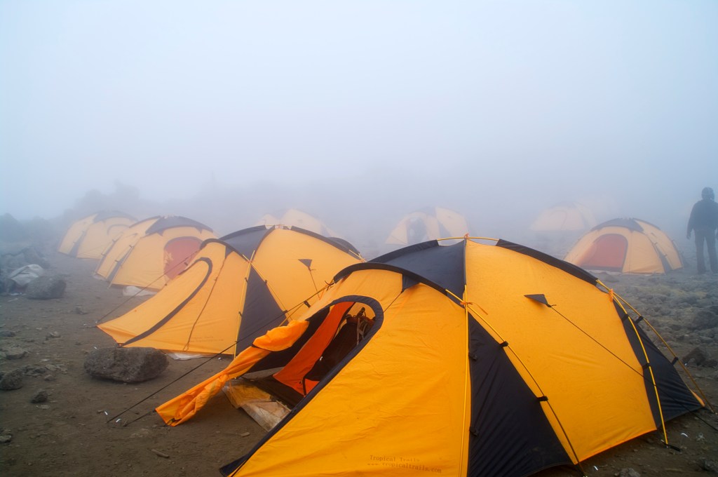
We continued on to the shouts of “Twende Twende”, the breeze remained keeping it perfect walking temperature, however my headache had re-appeared. The incline wasn’t troublesome as we reached the ridge of a small valley. The route follows a tiny river, gradually descending into camp. On the way down the clouds came in reducing visibility down to 20m or so.
The Giant Senecio trees loomed and lurked over us in the mist, giving a very eerie atmosphere, akin to a horror film. Thankfully Moses met me to guide me to the tent just as it started to rain. I flopped down onto the sleeping mat and took a couple of ibuprofen for the headache, and it soon cleared up. I think it’s the dry dusty climate that is causing my discomfort rather than the altitude.
Tents in the Mists
I called into the ‘Mess Tent’ for a cup of tea, to be told some bad news. A member of the party, Tim had developed a chest infection and fever. This is not good, as it presented a challenge to get someone down from here; a priority for his health. Prolonging his exposure to this height and the lack of Oxygen would only make it worse.
There is also another concern, the infection could spread to the rest of the group, which can easily happen at this altitude and conditions, my Himalayan Adventure a casing point. It would be the end of the ascent for those who contract it, I just hope if I were to get it, it would be on my descent.
The temperature really dropped as the evening wore on, I was loathed to get into my thermals. I had laid them all out to change into as quickly as possible, to limit my exposure to the frigid temperatures. For dinner it was carrot soup and spaghetti bolognaise, just what I need for energy and warmth!
There was a small Scottish contingent to the group, and one of the members, Sandy, after dinner said a few words thanking the guides and porters, then asked if we would all share a prayer to help us summit Kili and for Tim to have a speedy recovery. It was a nice touch and seemed to gel the group a little more.
Our head guide William also said, after speaking to the leaders of other groups, he reckons ours would be one of the first to summit. He probably just told us this, to boost our confidence, but I’ll take it! We then retired to our tents to get our much needed sleep. Tomorrow, we tackle the infamous ‘Barranco Wall’!
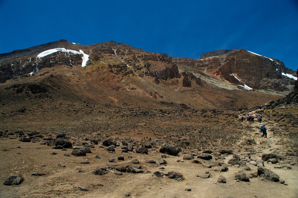
I didn’t get as much sleep as I would have liked, but on the plus side I still hadn’t developed a headache. The clouds had disappeared lower down the mountain, and the African sun was pulling no punches; it was scorching!
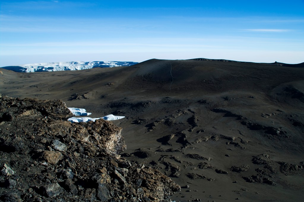
Kibo is now visible at last with the glacier crowning the peak, finally seeing where I am heading gave me extra energy to compensate for the lack of sleep. The trail up to midday was nothing too strenuous, however it is very dusty, far worse than the Himalayas. My snood was put to full use, and it is a must have for this trip. The low Oxygen is certainly noticeable now also, but it didn’t hinder nor make the morning difficult.
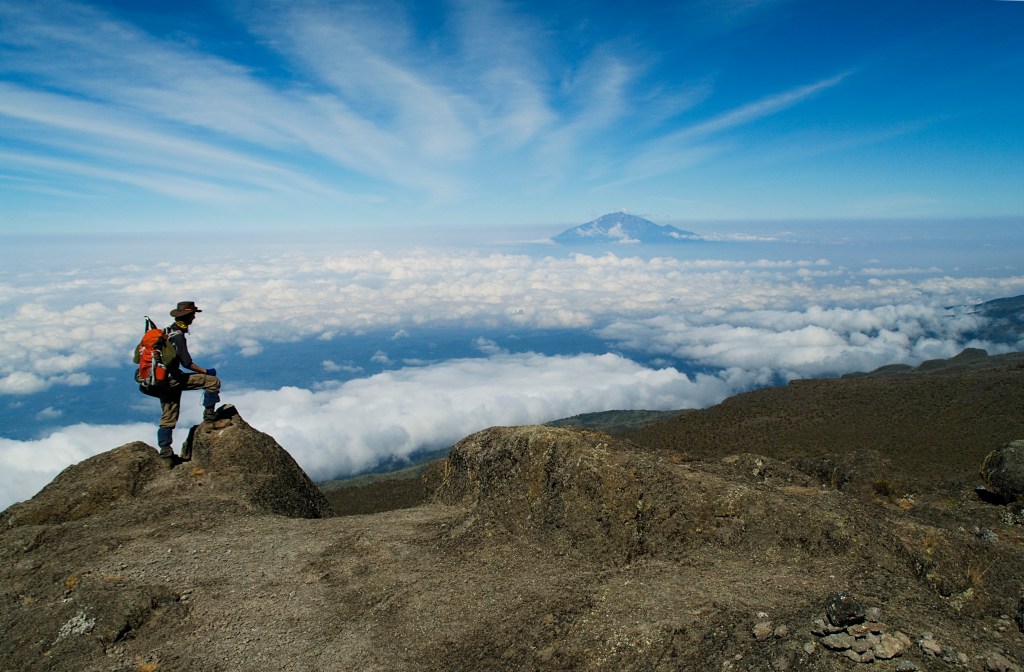
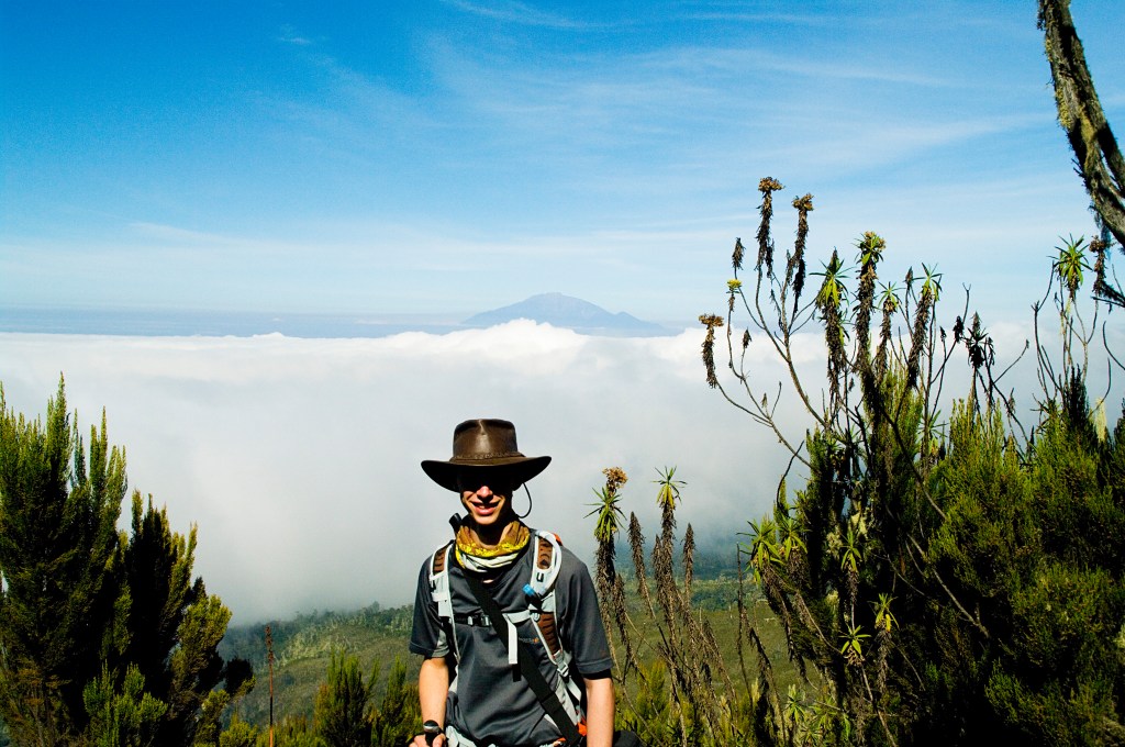
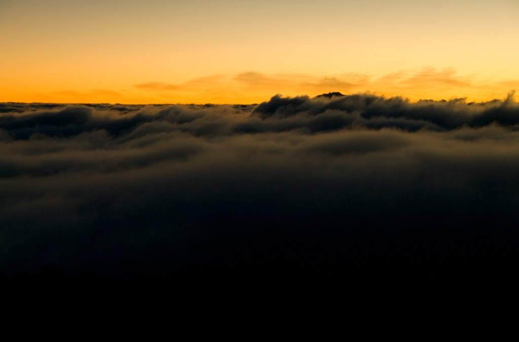
Once we emerged above the rainforest, we could see that we were above the cloud level. In the distance peeking out of this vast white fluffy carpet, stood Mt. Meru, in Kenya. For lunch we stopped at a group of boulders to eat our sandwiches. I perched on one, enjoying a cool breeze that picked up. It had been so hot to this point I had consumed all the water in my backpack bladder, all I had left was half of the contents of my water bottle.
Mt. Meru Poking Above the Clouds
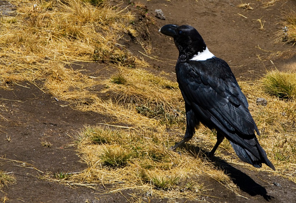
I relaxed in the sunshine with Meru in the distance. White Collared Ravens were also interested in my lunch, watching me attentively for any crumbs or scraps I’d throw their way. At the shout of “Twende Twende” (Let’s go Let’s go), lunch was over, and we donned our packs to make the last 2 hours to Shira Plateau.
White Collared Raven
The incline from this point increased suddenly, the route became more difficult to navigate as it became rockier and more unstable. The dust seemed to thicken, and I was caked in it. I developed a headache and my sinuses felt tight, my throat was extremely dry, likely due to the dust rather than altitude.
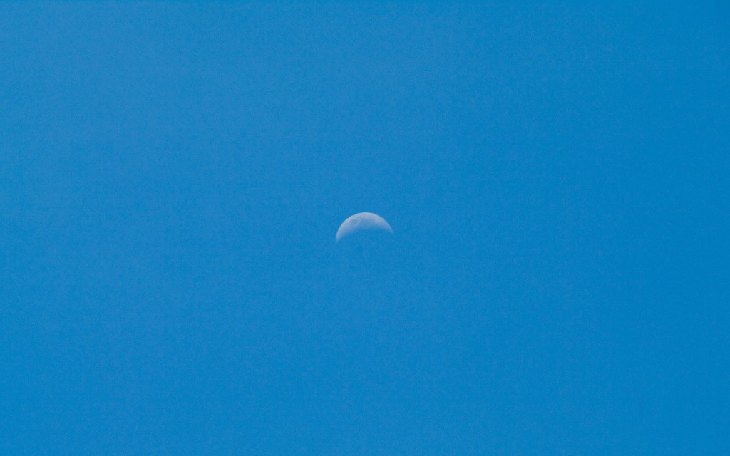
As I trudged on, I noticed that the moon was still visible in the sky, and it looked odd. It took me a few seconds to figure out why, and it was because I am now in the Southern hemisphere. The first time in my life have gone below the equator. The moon to me is upside down!
Odd Moon
The sun didn’t relent, and I was thankful to reach the Shira Plateau (3962m) where it was a gentle stroll to camp. Moses welcomed me and offered to carry my backpack to my tent. As soon as I sat down, I kicked off my boots and gaiters. I immediately grabbed the pack of baby wipes for a “Whore’s/Corby wash” (if you don’t know what one of these are, check out my Himalayan Adventure blog).
I took some ibuprofen and applied some tiger balm for good measure. I then just admired the view from my tent out over the valley I had just climbed, however it is now blanketed with the clouds; but Meru was still visible.
I took a stroll around the plateau to visit the ‘Shira Cave’. On the first ascents of Kili, the cave was used as a shelter, however it has eroded from the years of use, reducing it to a fraction of its size. It is prohibited to shelter in it now, but I still got a picture inside!
Shira Cave
On the way back to camp I got chatting to one of the guides, Samuel. He was telling me how much the glacier has receded over the 10 years he had been working as a guide/porter on Kili. A clear sign of the effects of global warming; he told me that there is now a lack of water travelling down the mountain, and it’s affecting the eco systems of the rainforest that covers most of the national park.
He also gave a bit of background on the Porters. For each group that climbs Kili, all the porters are from one tribe. So, each group will have a unique tribe to carry their gear. Every night at their camp, they would all dine, sing and dance together.
Once I returned to camp, it was time to answer the call of nature. This was a funny moment for me. For all the camps on the plateau, unless you were with the posh party that had their own toilet tent. We all had to share two long drops. One had a porcelain toilet over the hole, next to it, was the standard hole in the floor, squat type; plenty of these in the Himalayas.
There was a long queue for the porcelain toilet, that was in a right state having visited that one earlier. There was no queue for the hole, clearly these trekkers weren’t that well-travelled! I gave the line a quizzical look then walked past them all and entered the vacant toilet.
I then went to the mess tent for dinner before returning to my tent to catch the sunset. The clouds had moved up causing the summit of Meru to look like a shark’s fin, piercing a fluffy white sea to a golden backdrop, as the sun sank below the surface.