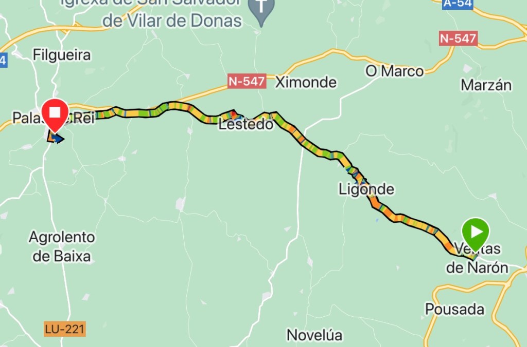
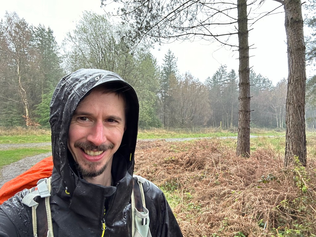
A lot shorter day however there was more rain. It had poured throughout the night but by breakfast there was a temporary reprieve.
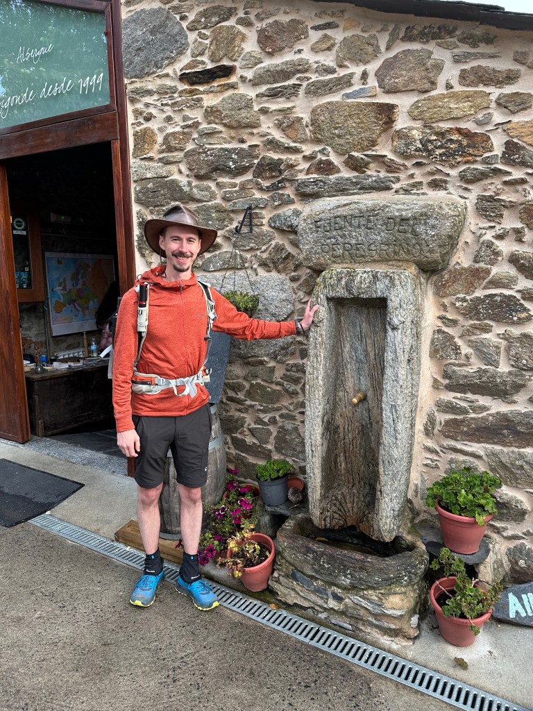
We decided to eat breakfast at the albergue before beginning the walking. The clouds still loomed overhead as we made our way into Ligonde where we called into a donativo.
It is run by volunteers from churches all over the world for a week at a time. There was an Egyptian, two Hawaiians and four Spanish hospitalarios. There all had buckets of energy welcoming the pilgrims for hot drinks.
Donativos don’t charge but accept donations. There is a water fountain outside that draws the water from an underground well; I filled my bottle!
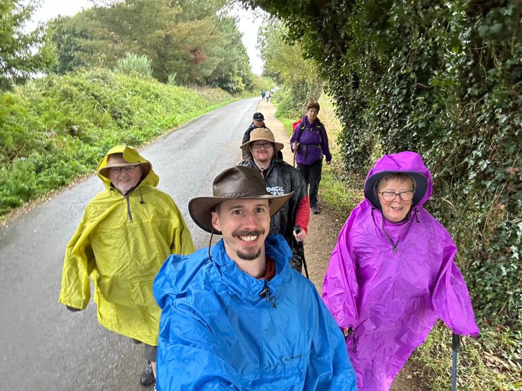
We continued on just as the rain settled in. Poncho time! We quickly donned our brightly coloured wet weather gear. The rain was on and off until Lestedo, where we stopped for a drink.
While here we met up with our Taiwanese friend from Casa Banderas, Janet. She joined us for a drink. The sun finally made an appearance, thus we packed our ponchos away.
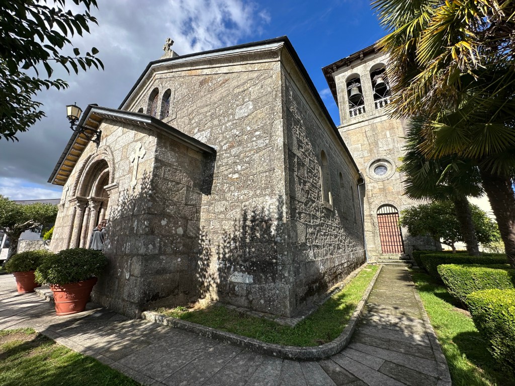
We called into the village’s little chapel for a stamp before continuing on. On our approach into Palas de Rei the rain returned and back on with the Ponchos.
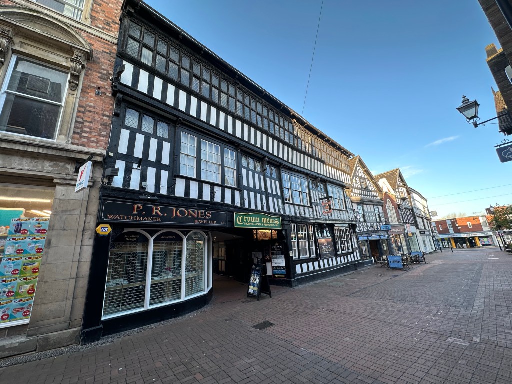
Once booked into the albergue we made full use of the washing machine and dryer before heading into to town. When I passed through here on my Camino, it was early morning and most places were closed, including the church, San Tirso.
However this time it is open, enabling me to get the stamp!
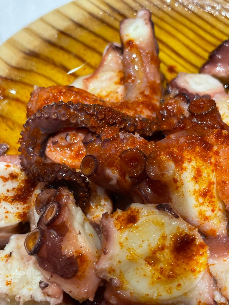
After a little look around the town we called into a bar for a couple of drinks before returning to the albergue. Tomorrow is Melide, the town famous for Pulpo (octopus). I’m looking forward to it, but I don’t think my mum would say the same!
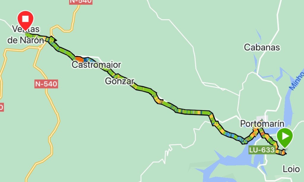
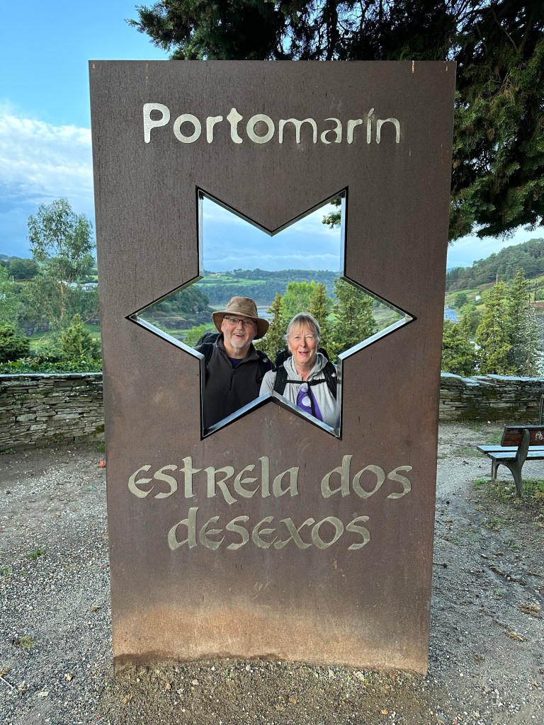
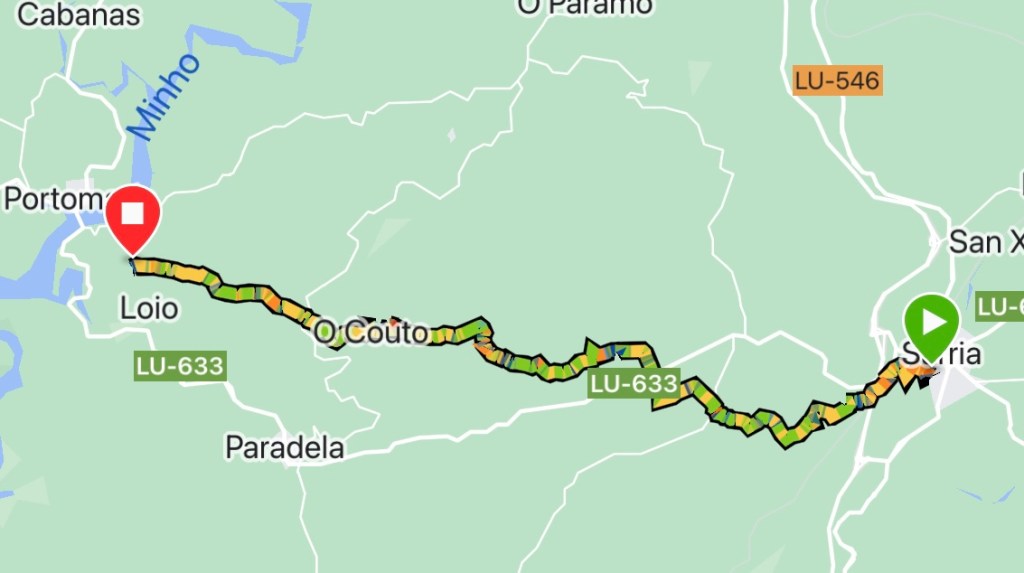
A shorter day was on the cards so we had a lie in, leaving the albergue at 0800h. It had rained heavily with strong gusts of winds throughout the night, luckily it had cleared mostly by dawn.
We made our way into Portomarin crossing over the river Mino where the foundations of a Roman bridge can be seen in the water below.
After climbing the steps from the centre of a roundabout up into the town, we stopped for breakfast.
Fuelled up we continued on down the hill to the river. The path follows the bank before cutting inland and upwards. Three pilgrims missed the turning, and after some shouts of “Peregrinos!”, I was able to point them in the right direction.
The climb was quite drawn out, but the path went through a woodland; no sound but for the wind and birds singing. The tranquility took our minds off the ascent.
Unfortunately the path met the main road, which ‘The Way’ follows mostly for the remainder of the day.
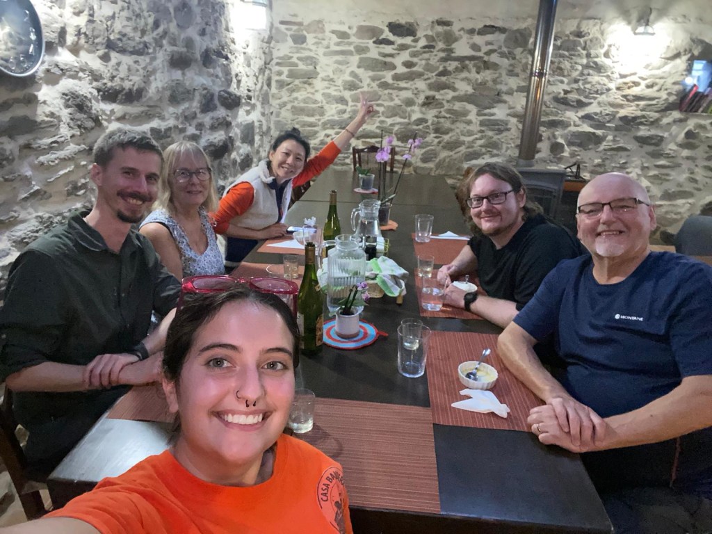
At midday we stopped in Gonzar for lunch of eggs and chips. Carbs and protein, a typical dish on the Camino. Here we met our Taiwanese friend from the previous night, however she is staying at the albergue here.
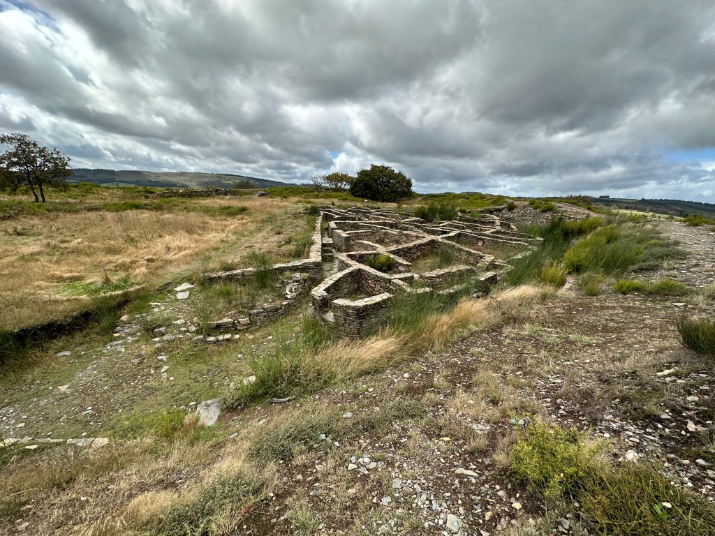
From Gonzar another hill had to be tackled, this one I remembered from the last time. However I missed the earthworks to an Iron Age fort that eventually the Romans took over; I walked right past it in 2021.
That was the last of the hills today and a gentle stroll into Ventas de Naron. It was 17.6km today, bit further than anticipated, and we managed to avoid the rain showers (mostly).
We had the pilgrims menu and a few beers to ease our aching muscles. It’s our first night in a true albergue, so will be a new experience for my group.
After two days of travelling and relying on public transport, planes and Spanish pizzerias. We arrived in Sarria late afternoon.
The only flight from Gatwick landed in Santiago at 2255h. The albergue I booked for that night shuts their doors at 2200h, however the hospitalario said she would leave the key at a pizzeria next door; I gave an ETA of midnight.
Everything was going to plan until we were on the runway, waiting for 30mins. But the Camino intervened with a tail wind, and we landed 10mins late; plenty of time to get to our beds.
After breakfast we got a taxi back to the airport to catch the coach to Sarria, just missing the morning departure by seconds. Once onboard the afternoon coach, it’s first stop was outside our albergue we had just left!
The journey pretty much followed the Camino, passing places I had stopped at two years ago; it was a nostalgia overload. So many happy memories.
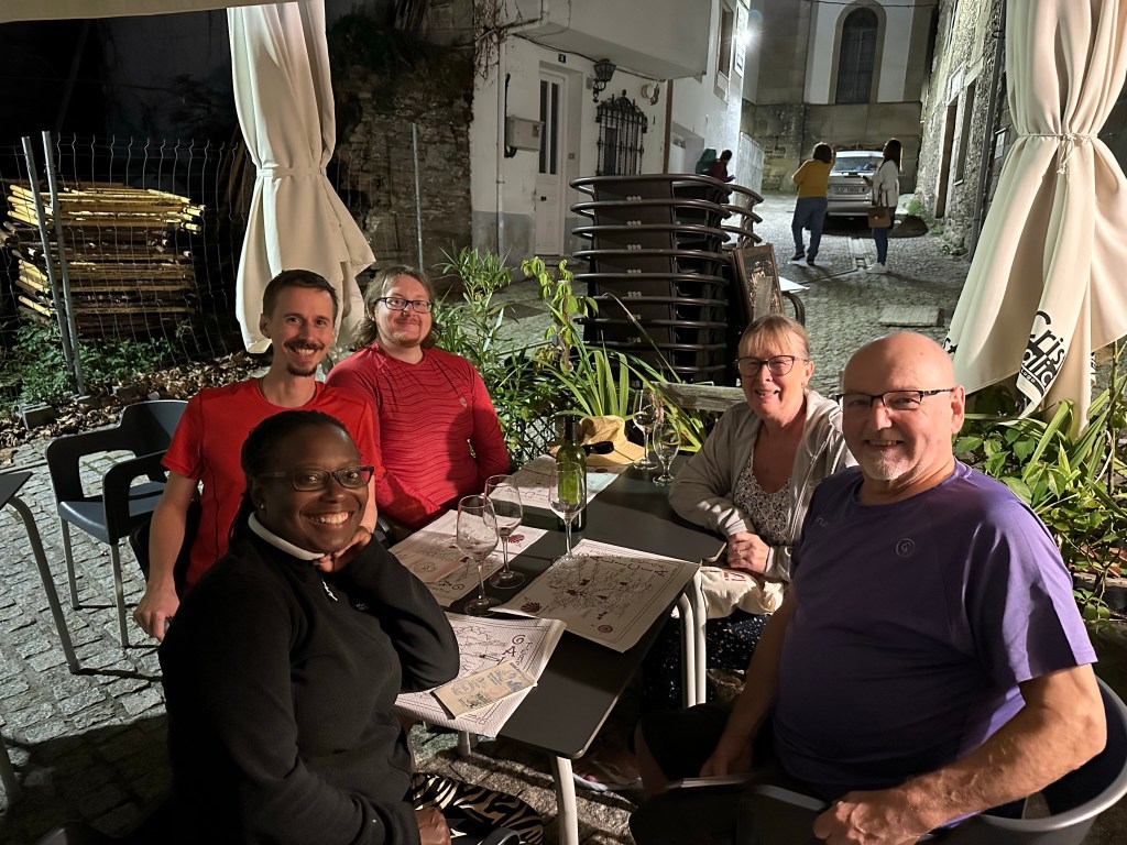
Once we got into Sarria and settled into the albergue, we went for some drinks and food. We met a solo pilgrim from Massachusetts who had started in Astorga. We invited her to join us for the meal.
A first taste of the Camino for my traveling companions. By 2200h we were back at the albergue for the night.
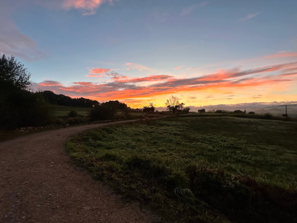
By 0700h we were out the doors on the Camino, head torches on, walking in the pre-dawn dark. That hill out of Sarria was still there! Just after dawn we stopped for breakfast before moving on.
The clouds came in and over the hills in the distance, rain was in the air, but despite the threatening weather it held off.
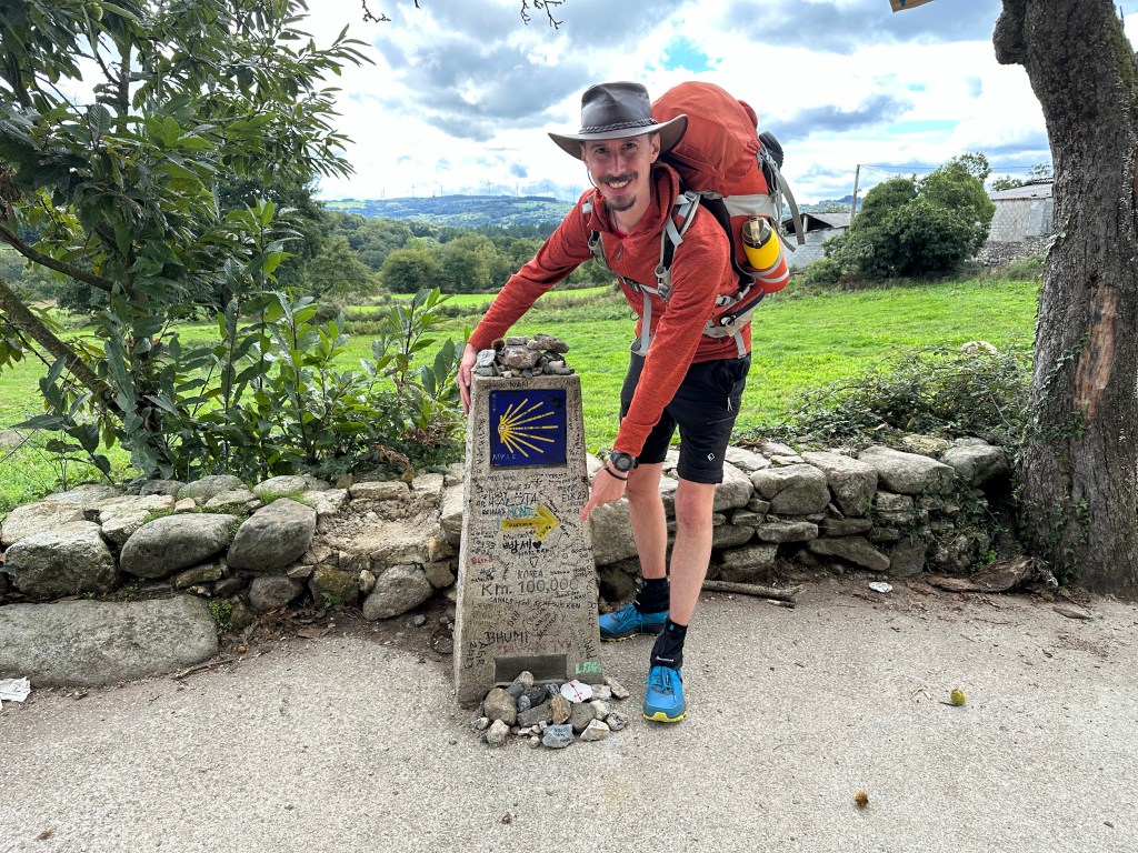
I managed to get a picture at the 100km way marker. Due to roadworks on this particular stretch of the route; I was I unable to get it in 2021.
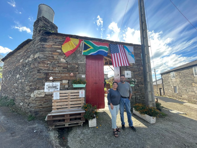
From there the kilometres passed by into Vilacha, where I had booked us into Casa Banderas. Although the owners Dominique and Ray are in the states, their daughter Gabrielle is looking after the place.
We had the communal meal with Gabrielle and another pilgrim from Taiwan, who started in St. Jean!
Today was 20km, a tough one to start with, but tomorrow is 15km with less of the hills. Hopefully a more enjoyable walk for my companions.
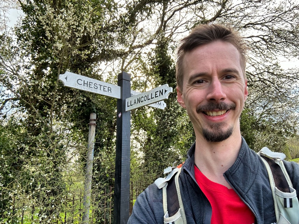
A year ago today I made my first step on the Camino Portugués, and I am again hearing the call for another pilgrimage.
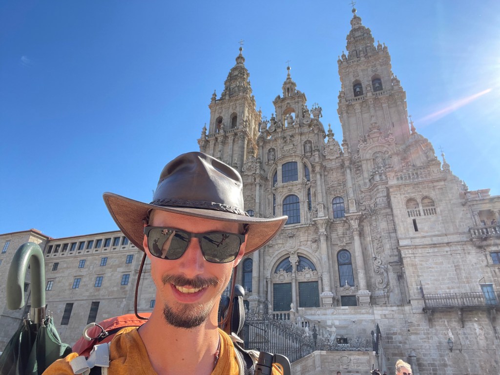
This time, my return visit to the Camino de Santiago is going to be a little different. I’ll be arriving in Sarria for the last 100km of the French Route, however I will not be a solo traveler. Having been inspired by my blog, pictures and stories of my adventures along ‘the way’, my mum, her husband Joe and Joe’s son Chris will be joining me.
This is a huge step out of their comfort zones, but they have nothing to worry about; I’ll be taking up the mantle of guide. Although Sarria to Santiago can be done in 5 days, it will probably take us a little longer.
I’m hoping to stop at ‘Casa Bandaras’ in Vilacha, the private albergue run by Dominique and Ray. It was one of my favourite stops in 2021; all the pilgrims shared a home cooked meal around the dining table with our hosts. It was an enjoyable evening of chat and laughter, a great example of the camaraderie between pilgrims experienced along the way.
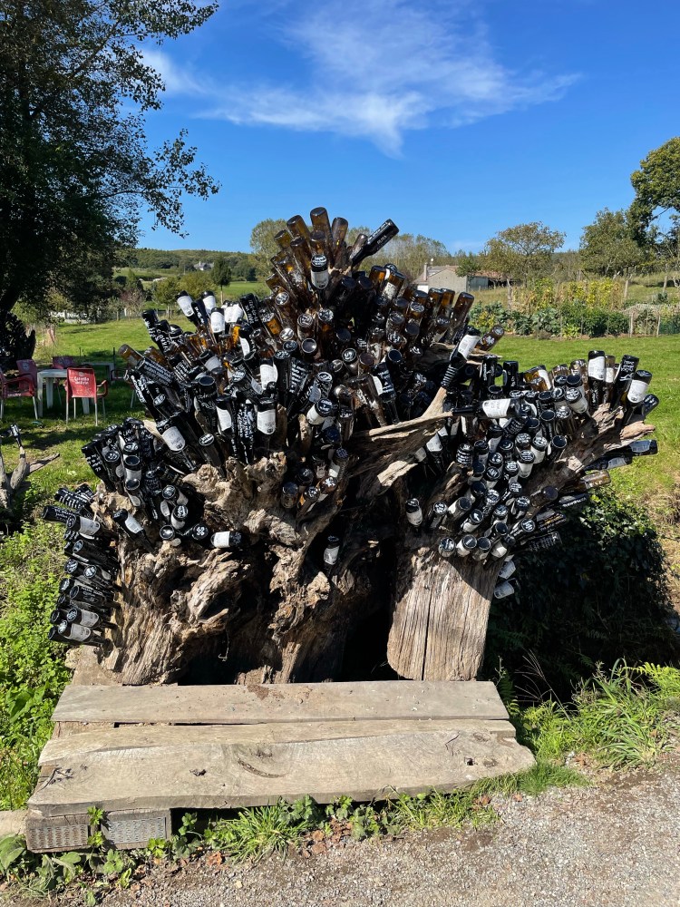
We will be calling into Melide for some pulpo and despite my mum already protesting, I’ll get her to try some of the town’s renowned delicacy. We will definitely be stopping ‘Casa Tia Dolores’; the bar that brews it’s own beer and the empty bottles used to make sculptures.
PulpoCasa Tia Dolores
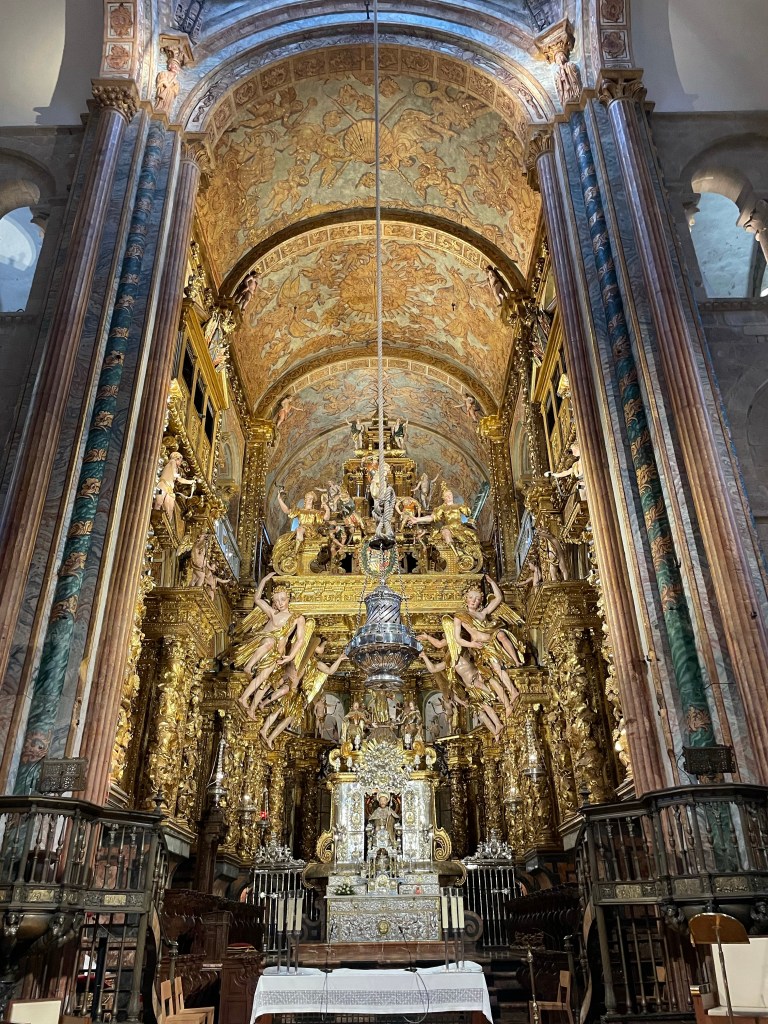
We’ll take up the hunt for the coveted wax stamp (I think I can remember where I got it). Experience albergue life, where I’ll witness their new found appreciation for earplugs! Maybe luck will be on our side and get to see the Botafumeiro swing.
Botafumeiro
I’ve been stressing that they will need to sort their footwear out, to avoid those blisters. Every time I’d visit my mum, she would drag me to an outdoor shop for more gear!
It will also bring back fond memories of my Camino and if my travelling companion’s experience a fraction of what I did, they are sure to enjoy their pilgrimage.
We will be setting off in a months time, and I can’t wait!
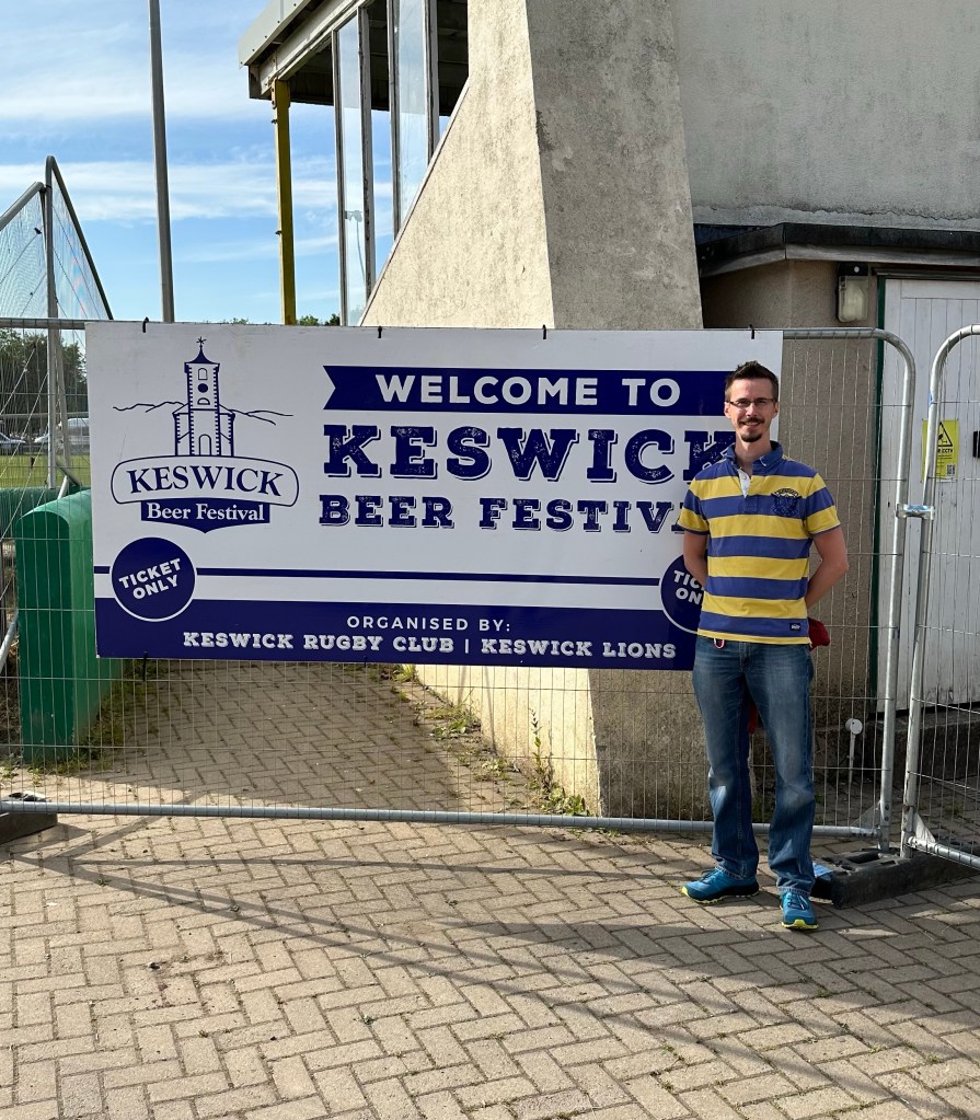
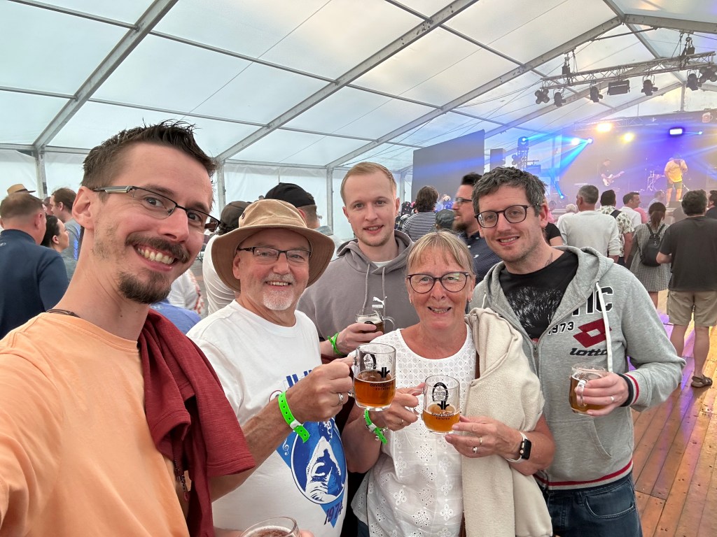
It’s that time of year again, where I make my annual pilgrimage to the Keswick Beer Festival. The weather has been very generous this week, which is just as well, as I’d forgotten to pack my waterproof coat!
We arrived late Friday afternoon after battling the M6 car park; the traffic was horrendous. As soon as the car was unloaded, we made a bee line to the rugby club for the festivities.
Sunday was a rest and alcohol free day to recuperate from the over indulgence of the Friday and Saturday. Milling around the cabin we had rented for the week.
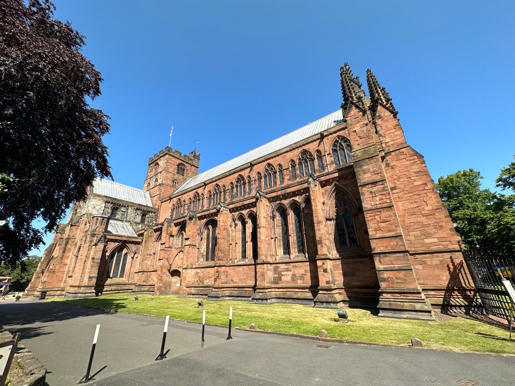
When I completed the Two Saints Way in April, while looking around Chester cathedral gift shop, there were pilgrim passports for collecting stamps from the cathedrals throughout the UK. Rekindling my joy for acquiring sellos on the Camino, I had to get one.
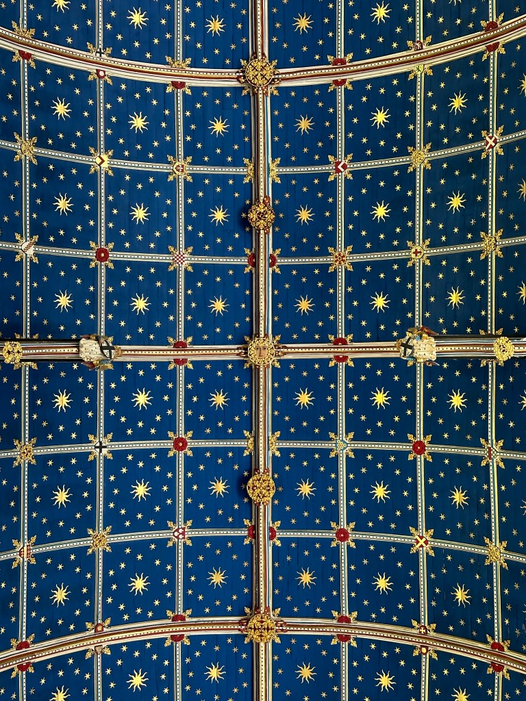
So Monday we caught the bus into Carlisle to have an explore and get a stamp from the cathedral. What a little gem it was, the ceiling is very unusual. It is covered in gold stars on blue backgrounds, inspired by Islamic and Moorish architecture.
Designed by the 19th century architect Owen Jones, who had a fascination in this style and spent time abroad studying it. We spent the remainder of the day exploring the city before catching the bus back to Keswick.
Carlisle Cathedral
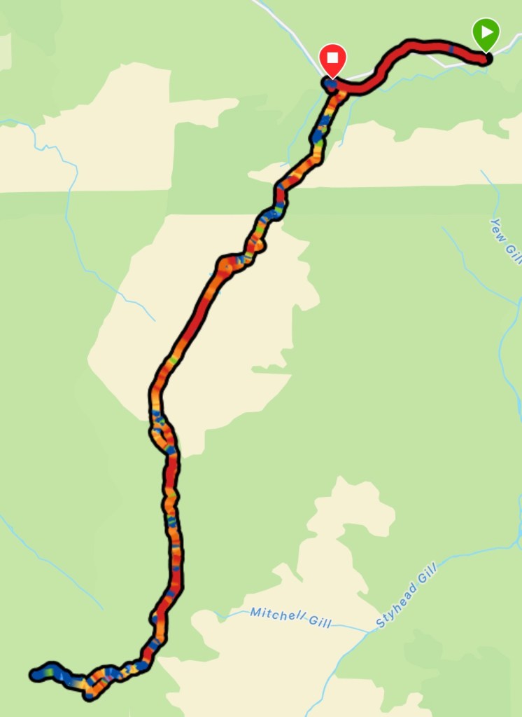
Tuesday I was itching to climb some Wainwrights, so I hopped on the bus to Honister slate mine, which is situated at the top of Honister Pass.
The bus was packed and with the current hot weather it overheated! Forcing the driver to stop to allow it to cool down; luckily it was within sight of the slate mine. I jumped off deciding to begin my walk from there.
My target for the day was Great Gable. The 7th highest of the Wainwrights. I picked my route so I could tick of three smaller ones on the way up.
Straight from the mine it was a devilish incline following a fence line, that proved useful to hold on to and propel myself upwards. After 40min or so, the incline softened as I reached ‘Grey Knotts’. A gentle gradient led me to the next Wainwright, ‘Brandreth’.
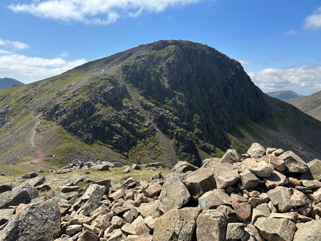
As I summited my second peak of the day, I got my first glimpse of Great Gable. It loomed above its neighbours and looked steep! The path dips down then up Green Gable before fiercely ascending to summit.
Great Gable
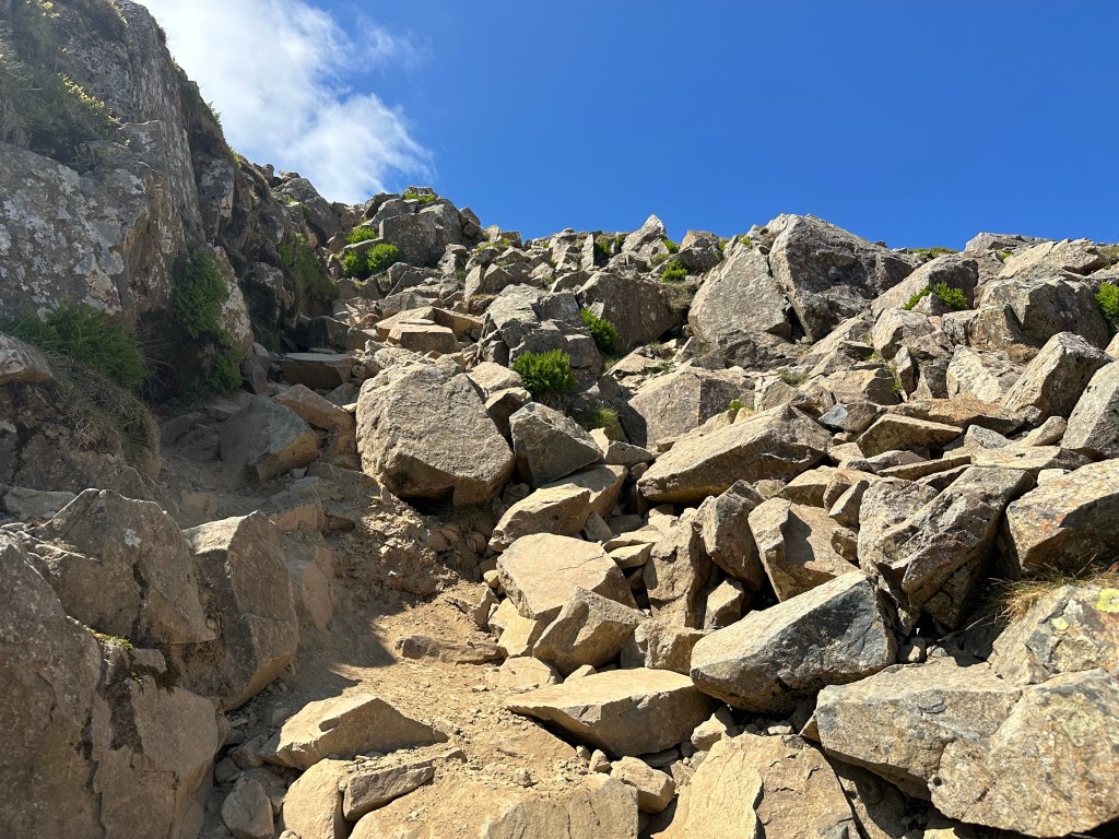
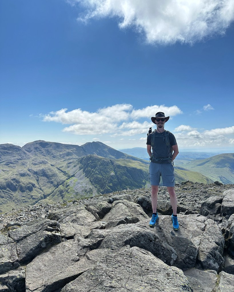
Soon I was scrambling up a boulder field, with plenty of loose rocks that would tumble down at any poor foot placement. I persevered and reached the summit. One side ‘Scafell Pike’ dominated the skyline in the distance and to the other ‘Skiddaw’.
It’s Scrambling TimeGreat Gable Summit
I wanted to descend via a different route so I could walk around the north face to get a close up of Gable Crag. However this would prove to be a huge error. On the map, I took the northwest path.
It started off fine, with plenty of rocks and boulders to hold on to. The path that skirted the mountain below came within sight, but all the boulders and rocks had disappeared, leaving a very steep descent with rust coloured loose shale under foot.
I tested it by holding on to the last remaining boulder as my anchor, tentatively placing my foot down. It just slipped sending a stream of dust and stones cascading downhill; far too dangerous to continue this route. I was forced to turn back towards the summit.
After summiting Great Gable for the second time, I descended the way I originally came, arriving back at the slate mine in time to catch the bus back to Keswick.
Honister Pass
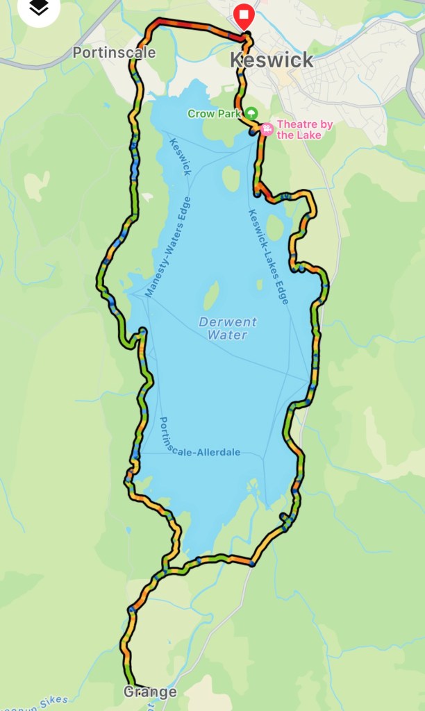
Wednesday a walk around Derwent Water was on the cards, making the most of rare sunny weather. The start and end point being the Greta bridge, firstly heading towards Crow Park to follow the shoreline clockwise.
The last time I did this route, it was raining cats and dogs. A complete different experience to today’s sunshine. I have been very lucky with the weather this year.
After a quick pint at Mary’s Mount, we continued on taking a slight detour into Grange for ice cream at a little café, before returning to the route following the western shore.
After helping a local recover three escaped sheep, returning them to their field, the route followed the shady paths along the lake.
Once we reached Portinscale we called into the Derwentwater Hotel for a cheeky pint, enjoying the late afternoon sun in the beer garden. From there it was a short walk back into Keswick.
Thursday, our last day, we took a bus ride to Rosthwaite and Buttermere. Two tiny but picturesque villages. Rosthwaite is nestled in the Barrowdale valley, hardly touched by time.
A hidden slice of heaven, with open fields of wildflowers and grazing cattle, surrounded by the towering Wainwrights.
Buttermere village sits between Buttermere and Crummock Water. It seems to have more pubs and cafés than homes! A village has been on this spot since the Vikings dwelled here.
After some lunch and drinks, we hopped back on the bus returning to Keswick, calling in at ‘The Round’ for dinner completing this year’s Keswick adventure.
Now I need to start preparing for my next adventure in three months time; here is a little clue for what it is.
It’s has been just 18 days since I completed ‘The Way of St. Werburgh’ and after a very busy couple of weeks at work, I have managed to find some time to put together a quick video of the journey. It can be found here:
Over this pilgrimage I filmed longer videos and narrated them for a vlog type project, giving a bit more detail for you to experience the joys and challenges that this solo hike entailed. I did them all on my phone, so don’t expect any Spielberg epics.
I’ve never done a vlog before, and playing back some of the footage during my editing is a bit cringe; hopefully if I get the courage to post them, it would at least give you some laughs. It is safe to say, currently, I am a better blogger than a vlogger! I’ll make a post when I’ve built up the confidence to post them.
My blogs are a hobby for me, and in the same spirit as are any vlogs I publish, and I won’t take them too seriously. For now, I hope you enjoy this quick montage of my Two Saints Way.
It was the polar opposite to yesterday. The weather played ball, I even caught the sun! The way markers were 99% of the time on par. There was one marker coming out of Bunbury that was on the wrong direction, however it was a dead give away, as it wasn’t pointing to the big hill with a castle on top.
After spending the night in one the most craziest buildings, I was refreshed after the previous day’s antics. The Crown Hotel, doesn’t have a single level surface. The floors all slope, the stairs are crooked, not even the toilet roll holder was straight! What topped it off was the hot water came out the cold tap.
I was in one of the rooms at the top to the left
It’s a very oldie worldie place and it’s all part of its charm. If a building was to be haunted, it would be this one. (Although I didn’t experience any ghostly apparitions, but that could be because I slept like I’d just walked over 40km).
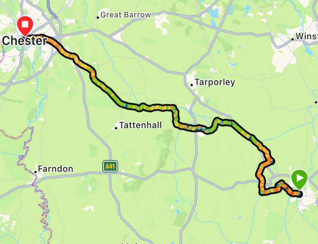
At 7.30am I started my walk to Chester. Once out of Nantwich I joined the Shropshire Union Canal, lapping up the sunshine; although there was a biting wind. At Acton I left the canal to cut across fields to join the Llangollen Canal.
I followed this until it joined the Shropshire canal after a series of steep locks. Finding the sign pointing to Chester, I followed the towpath, pausing once to chat with a fisherman preparing for a competition at the weekend.
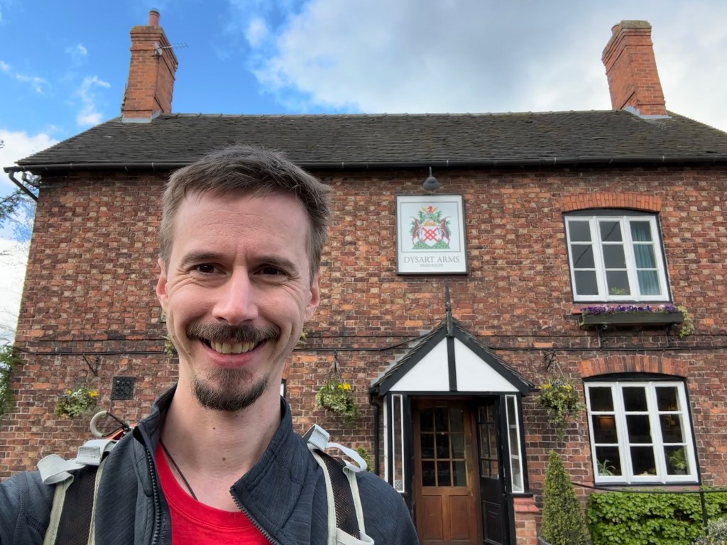
The route leaves the canal at Bunbury along country roads. Opposite the church, the ‘Dysart Arms’ was advertising ‘Elevenses’. Looking at my watch it was 11 o’clock; it would be rude not to stop.
Elevenses
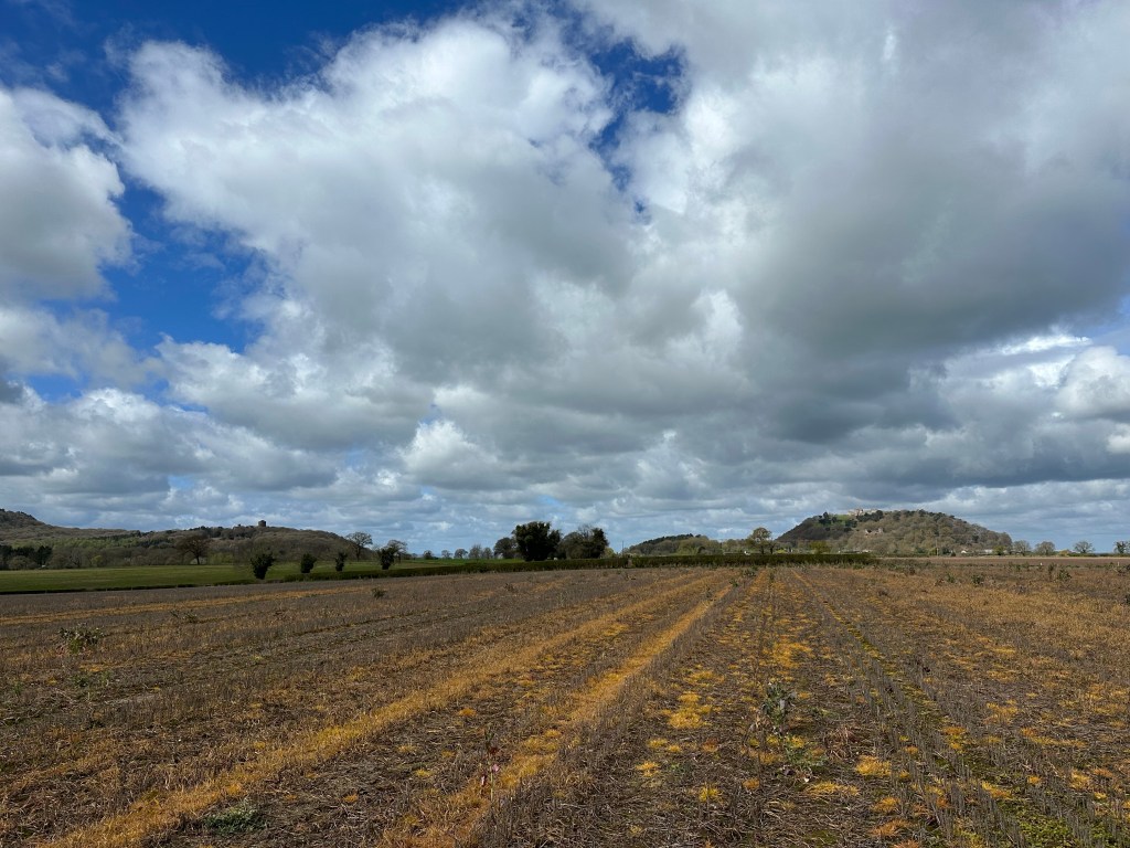
After my food and refilling my water bottle I hit the trail into Beeston. The castle ruins sitting on top of a freestanding hill became my focal point. From the castles entrance (at the bottom of the hill – no way was I climbing up) I cut across fields back to the Shropshire Union Canal.
Beeston to the Right
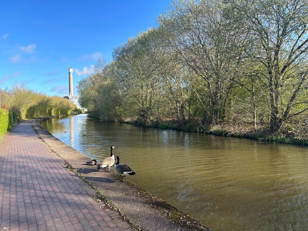
I followed the canal all way to Chester Cathedral. It was so peaceful and tranquil walking the towpath. Listening to the birds sing and the wind rustling through the trees and hedgerows made the kilometres flyby.
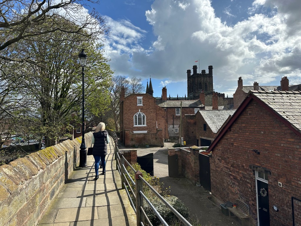
Although I had a headwind, it was welcomed as it kept me cool. Soon the countryside gave way to the suburbs of Christleton then the outskirts of Chester, right into the heart of the city, below the old city’s walls.
Up a flight of stairs and I was walking these fortifications with the Cathedral to my right. Following the signs, I walked along St. Werburgh Street to the entrance.
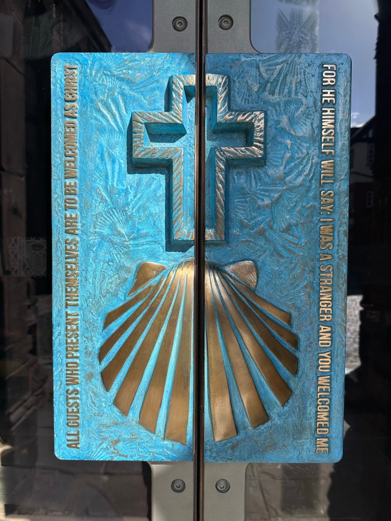
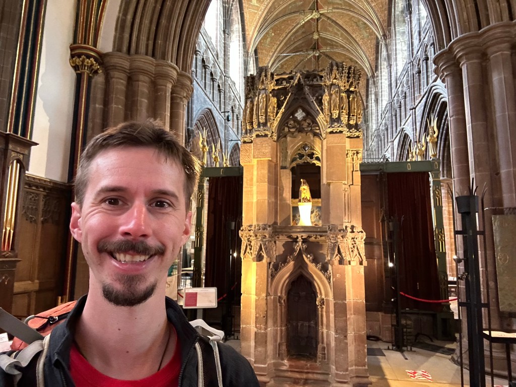
I had completed my pilgrimage, and emblazoned on a door was the scallop shell, bringing back memories of the Camino. I went inside as the journey isn’t complete until you stand before St. Werburgh’s shrine, tucked right at the back in a little chapel.
Robert Burns once penned, “The best laid plans of mice and men often go awry” in his poem ‘To a Mouse’. No truer words could describe todays journey.
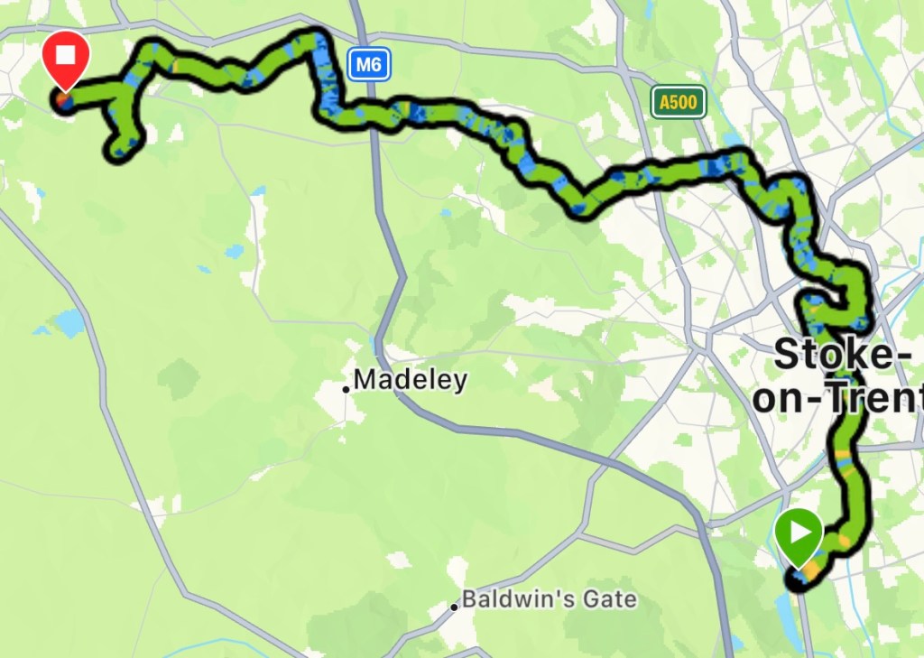
The sun was out although a little on the chilly side, when I rejoined the trail at Trentham. The path follows Longton Brook before cutting through a housing estate to join the Trent and Mersey Canal.
Seems simple on the map, but not the case. The markers were scarce and map wasn’t helpful, as it didn’t show the exact location where the route joins the towpath. I ended up wandering the cul-de-sacs for a way onto the canal for a good 15mins. In the end I had to ask a chap who was loading his car. Typically it was back in the direction I had come.
Once on the towpath it was an easy walk into Stoke, leaving briefly to Stoke Minister before rejoining the canal out to Hanley. The way goes around Hanley, Cobridge and Burslem, through all the retail and industrial parks.
The markers and the map failed me again trying to get back to the canal from Burslem. The markers led to a dead end and a path that would have led me further down the canal was just scrubland.
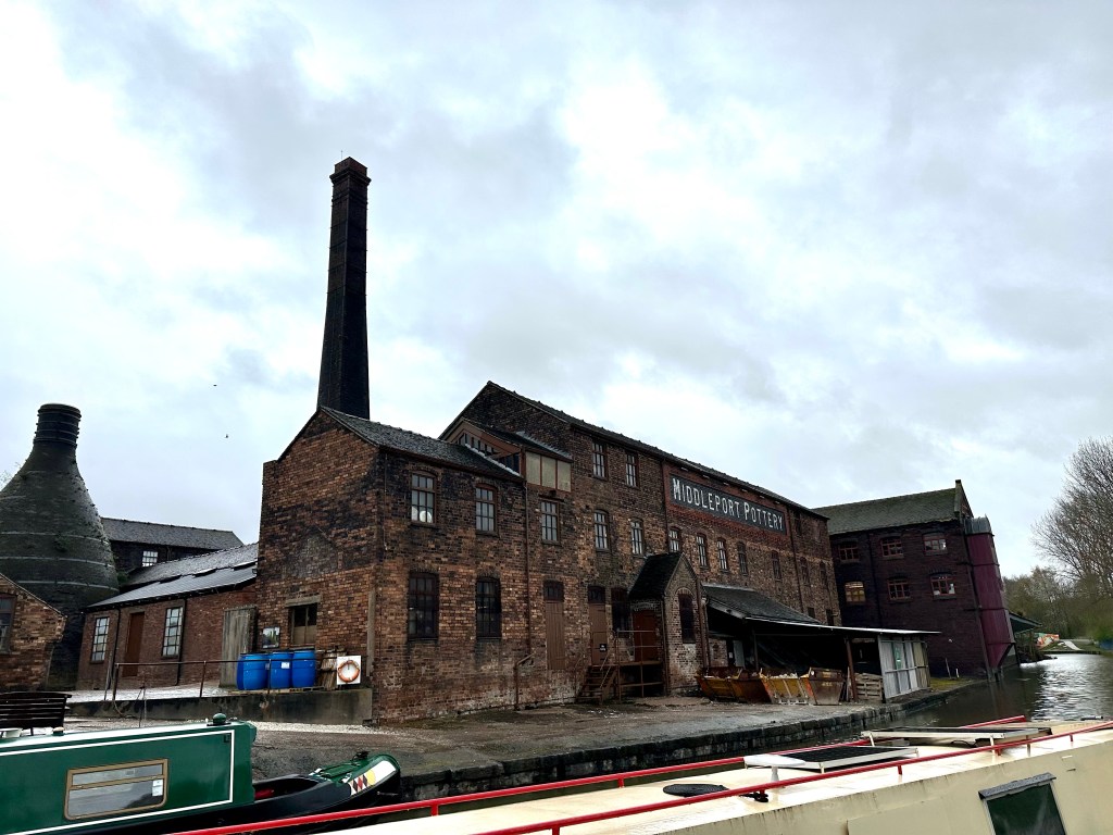
When I finally rejoined the towpath at Middleport Pottery, I wasn’t far from where I left at Hanley. Basically a loop around Stoke’s industrial estates.
I crossed under the A500 into Bradwell, where a huge line of bikers were following a hearse into the crematorium. I waited for them to pass, more out wanting a rest than continuing on.
20km in, I finally reached Chesterton, on the very edge of the city. Although that wasn’t half way, I still had about 26km to go. All the dead ends and detouring had added to my distance covered.
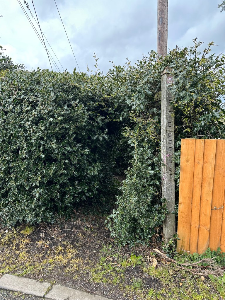
I made tracks through the countryside at last however my marker woes didn’t end in Stoke, the same problem occurred in ‘Woods Lane’. The marker was hidden within a holly bush, that the route went through. It was a tunnel of pain, by the time I reached Audley I needed a pint.
Tunnel of Holly
I called into the Butchers Arms for a swift half. A group of bikers filled the tiny bar. I ordered my drink; upon seeing my pack they enquired about my walk. They had been to the funeral however they didn’t see me resting while the procession passed.
We all had a good chat about the various hikes we had done. I could have stopped for one more, but I still had 20k to go. I left as another rain shower arrived.
I clocked over 30km and I was starting to flag, this meant it was time for music. I got my earphones out and put some upbeat tunes on. My pace quickened.
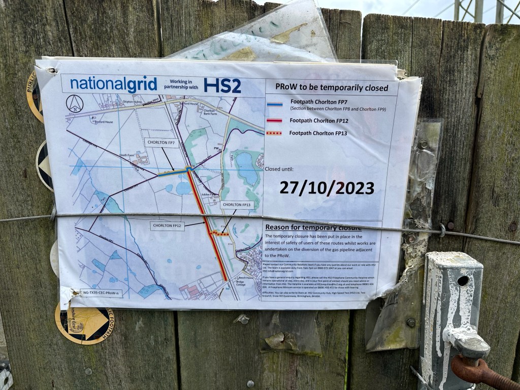
However this all came to a halt at Chorlton. Works for the HS2 blocked the route, I followed the diversion but it wanted me to go down none existent paths. Checking the map there was another route that would join the TSW at Wybunbury.
But housing works south of Chorlton scuppered that idea. I had to back track and follow the road into Hough, I had wasted an hour with this folly.
The distance to my destination was going up by this point and I had covered 39k, 12k still to go according to the app. I had to call a taxi to take me into Nantwich. My watch was showing 41km by the time I got into Hough; pretty much what the distance should have been if the day had stuck to the script.
With that in mind, I don’t feel it would be cheating if I set off from Nantwich tomorrow and not get a taxi back to Hough.
Hopefully my marker nightmare is now over and I’ll be in Chester tomorrow evening! The end the Way of St. Werburgh.
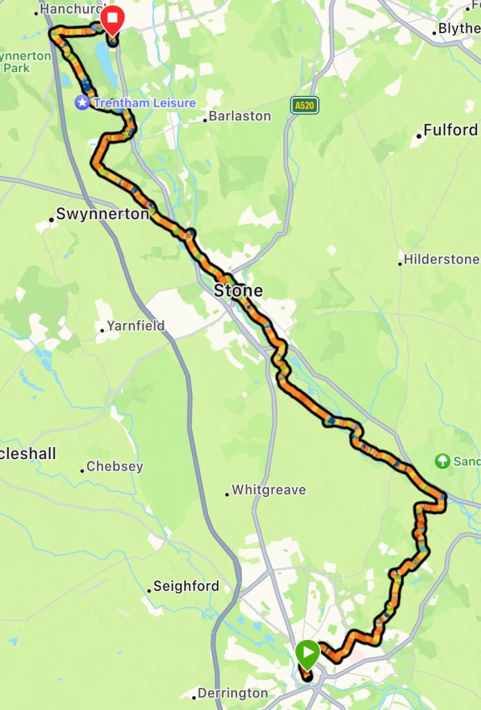
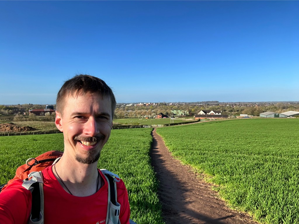
Absolute glorious start of the day, not a cloud in sight with the temperature cool enough to make it perfect walking conditions.
Picking the trail up from where I left off, at St. Chads, it follows the high street up and around HMP Stafford. I didn’t envy the prison officers who were arriving to start their shifts.
After cutting through some allotments I was on the stretch out of the town and into the countryside. A short rise to Beacon Hill gave lofty views over Stafford.
From there I passed through Hopton and inadvertently took the scenic route into Salt before joining the towpath along the Trent a and Mersey Canal into Stone.
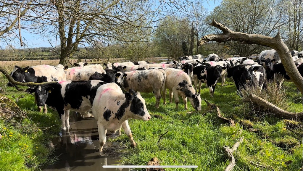
The towpath was a bit tricky to navigate due to slippery mud. At Burston, the path leaves the canal and cuts across farmland. Over a very boggy field, which the exit gate was blocked by cattle. (What a day to choose my red top!)
Mooove out of my way
I slowly made my way through the inquisitive cows trying to avoid the puddles hidden by tufts of grass. Although they came up to me they wouldn’t get within my arms reach, and they parted way to allow access to the gate.
About a 1km more and I was back on the towpath into Stone; I arrived for midday, perfect timing for lunch. I called into a cafe for a halloumi and red pepper wrap.
Conscious that the good weather wouldn’t last, I soon got underway. After a brief walk along the canal, I left Stone behind, winding my way up Bury Bank. This is one of the possible places where St. Werburgh was born.
It was at this point I could feel the rain was in the air; I reluctantly put on my waterproofs in time for the first droplets to fall.
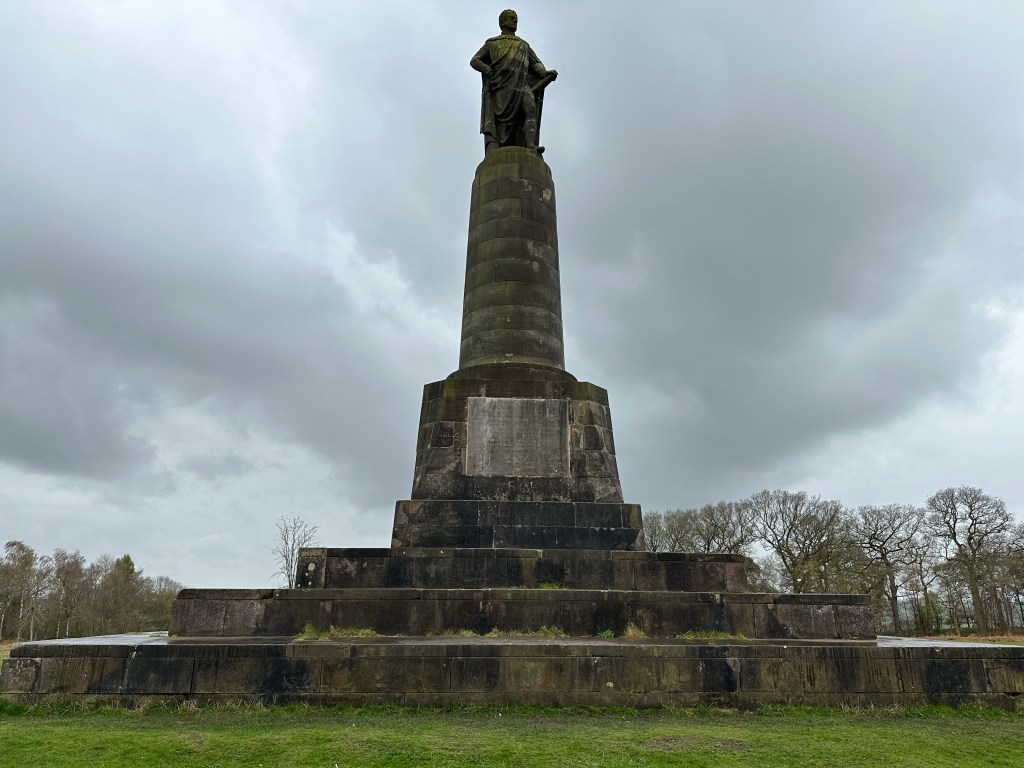
I descended into Tittensor marking the last leg for today. After a steep ascent to George Granville’s monument that over looks Trentham Gardens, it is back down to the edge of the monkey forest. (I think the rain had kept them indoors, as I didn’t see any)
George Granville watching over Trentham
As I had just gone downhill, that means I now must go up. It was a very steep incline through the woods, it felt like the highest gradient so far on this trek.
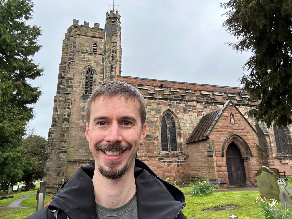
It joins a ridge line called Kingswood Bank that I followed for a kilometre or so before descending into Trentham where I ended this stage at the church. I met my dad at the entrance to Trentham gardens, I’ll be staying at his tonight and will give me a lift back in the morning; although tomorrow is the big one and the forecast predicts gale force winds and plenty of rain. I’m having flashbacks of Skiddaw last October!
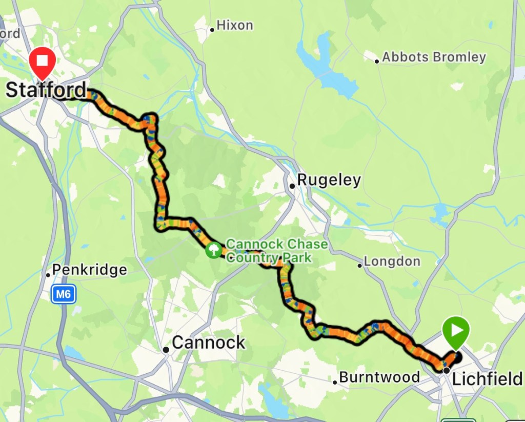
It was a wet start to the day and to make matters worse, my phone hadn’t charged over night, with only 34% juice left. Figuring it was the cable, I had to wait around for the shops to open to get a new one.
Tesco opened at 8am. 30mins later I had a new cable, my lunch and started out on the walk. Being a veteran on these sort of jaunts, I had packed my power bank. My battery worries now over, I got to what I do best, walking.
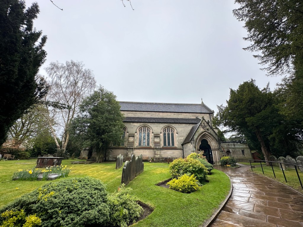
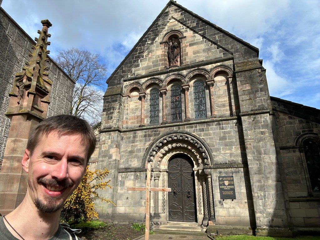
St. Chads, Lichfield
Three kilometres later I had left Lichfield behind following a country road in the direction of Cannock Chase. Thankfully the rain eased.
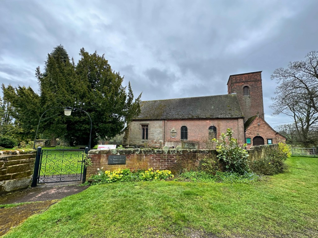
The first village out of Lichfield is Farewell; the route passes behind the church. Saying farewell to Farewell Church, it is country fields and small forest trails to Gentleshaw, which is on the edge of Cannock Chase. 10km down!
Farewell Church
Into the chase I went. Woodland as far as the eye could see. This is also the hilly section of day. Following the undulating path dodging mountain bikers, whom were more mud than cyclist, I enjoyed the scenery.
The sun was desperately trying to break through the dark grey clouds, but they loomed over menacingly. At 14km I stopped and ate my pasta while sitting on a gate. There is a lack of picnic benches!
After another 2km, the down pours forced me to put my coat back on and zip up. With the wind, the rain was driving sideways. After 10mins I was sure that was it for the day. However as quickly as the deluge started, it was chased away by beaming sunshine! Best thing is, it remained sunny for the rest of the way into Stafford!
Who’s idea was it to walk this week?
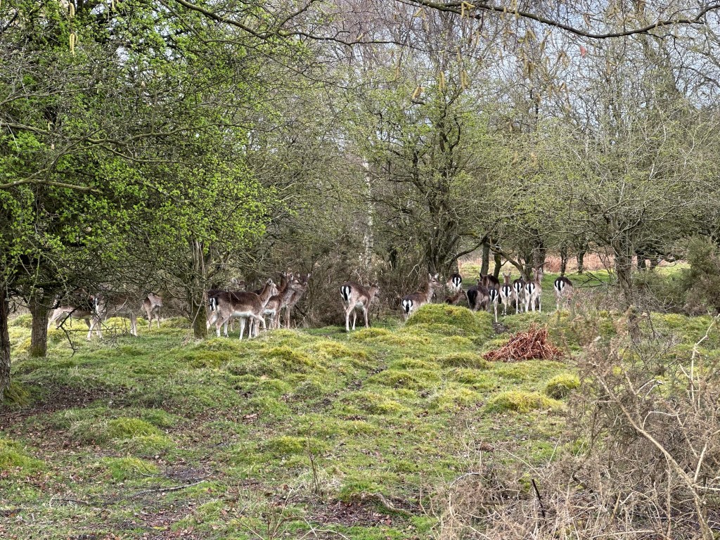
While weaving through the woods I came upon a herd of deer. At first I thought they were painted wooden sculptures (they weren’t moving and I didn’t have my glasses on). As I got closer I saw one of their ears twitch.
Shortly further on I came up to an even bigger herd, right by the path. Although they kept an eye on me, they didn’t seem to mind my presence.
Have they got penguins for tails?
With the sun shining and the route now going gently downhill, I was in my element. I exited Cannock Chase at Milford to begin the last leg into Stafford.
I chose to join the Staffordshire and Worcestershire canal to avoid a section that passes sewage works. Eventually I left the canal to follow the banks of the river Sow into Stafford, completing the day’s walk at St. Chads Church. It’s been a journey of the two chads.