Birdlip

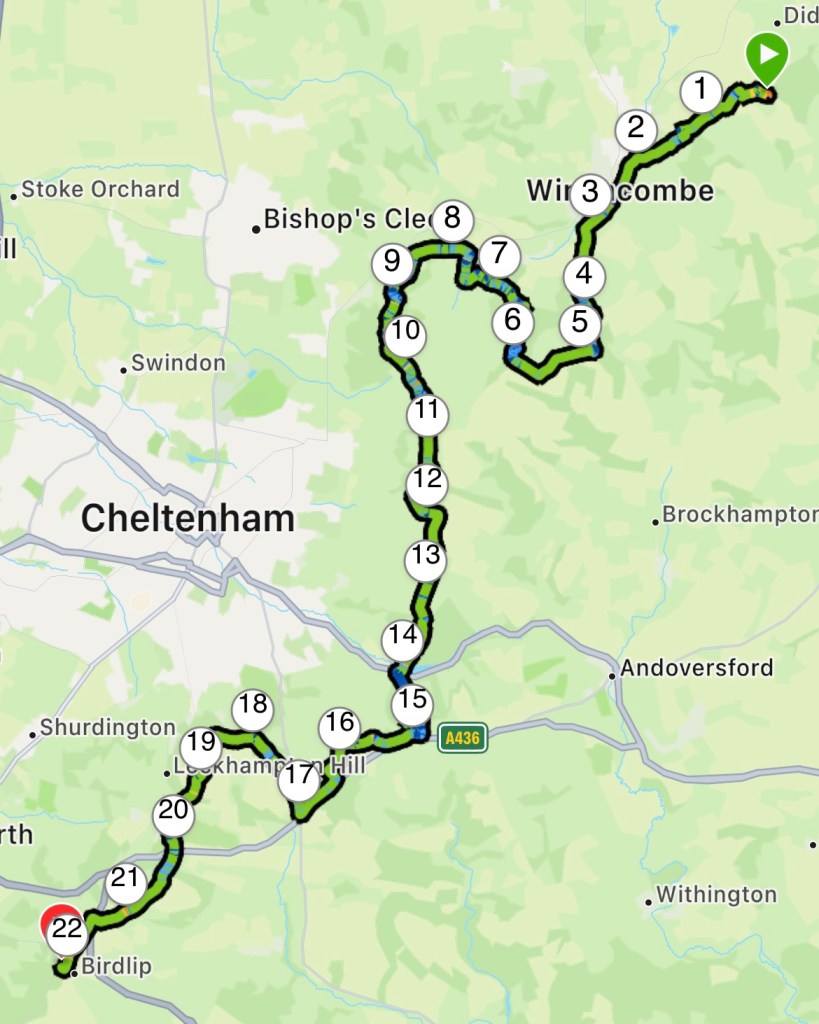
Well today didn’t stick to the script. It felt like it has been up hill for 22 miles; of course it wasn’t, but it certainly felt like it. I certainly found it tough today.

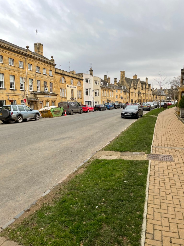
I left the campsite just before 0900 and covered the 2 miles to Winchcombe in no time, passing the ruins of Hailes abbey. I called into a newsagent for a meal deal as there are no villages between Winchcombe and Birdlip.

Abbey Ruins

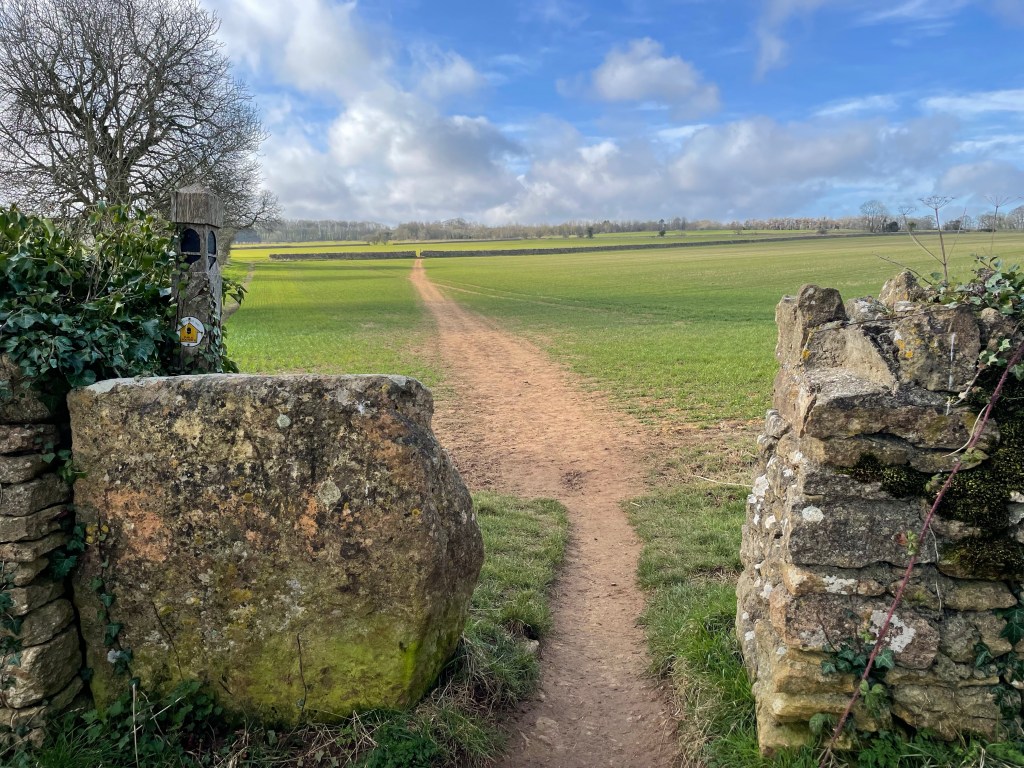
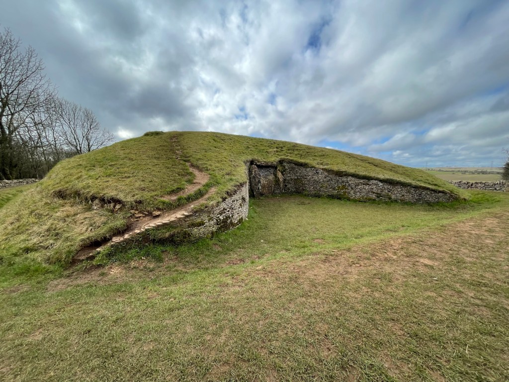
I made my way back on the Cotswold Way, starting the incline up to Belas Knap Long Barrow. I got chatting to a couple who had done the Camino!

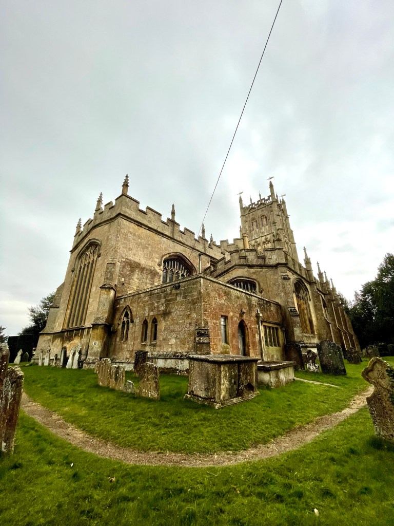
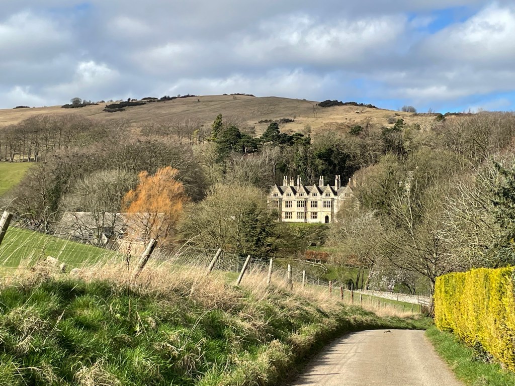
From the barrow the route cut across farmland before descending through woodland to Postlip. the small hamlet dominated by Postlip Hall.

Postlip Hall

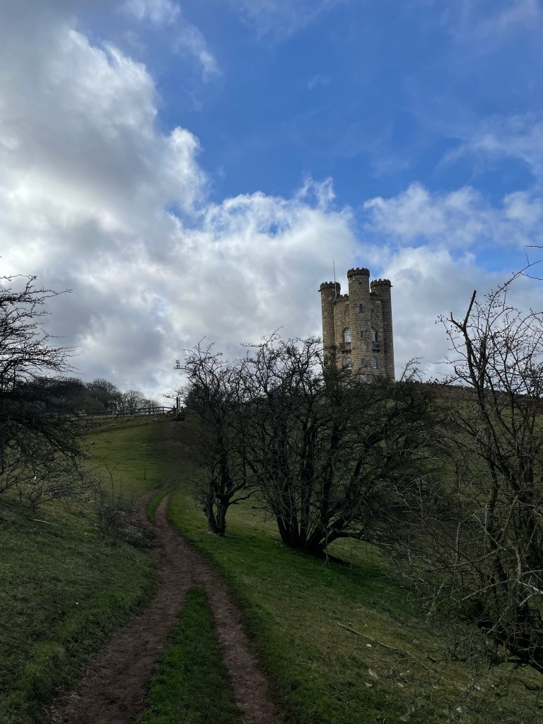
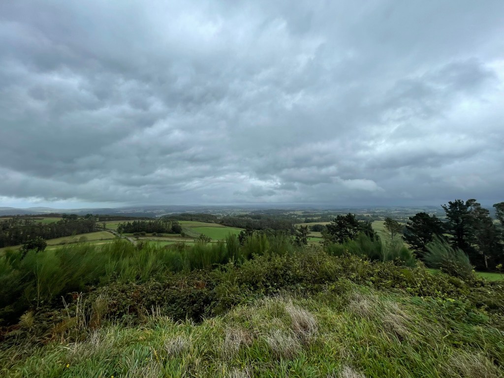
From here it was an ascent to Cleeve Hill with a head wind. I stopped just before the summit for lunch before continuing. The way follows the edge of the hill range, winding around crags and sharp drops. The path skirts south of Cheltenham, giving lofty views of the city and the racecourse.

Cheltenham racecourse

Soon I hit a descent before again climbing another steep hill, this one too snaking around the edge, eventually overlooking Gloucester. At this point the light was fading and I still had some distance to cover.

Gloucester

After making my way down I reached Ullenwood. It was 1720hrs at this point and the route took a right through the village. I was really flagging and I sat on a grit box at the side of the road to assess my options.

If I followed the Cotswold Way it ascended another hill or two, continued to snake around the edges before reaching Birdlip; another 4-5 miles at least.

However Google maps showed I was 1.8 miles away from my destination. But meant I would have to follow an ‘A’ road; unless I cut across a woodland park, involving short but steep hill!

It would then join a country road into Birdlip. My options were follow the route, take the short cut or get a taxi; the taxi was very tempting.

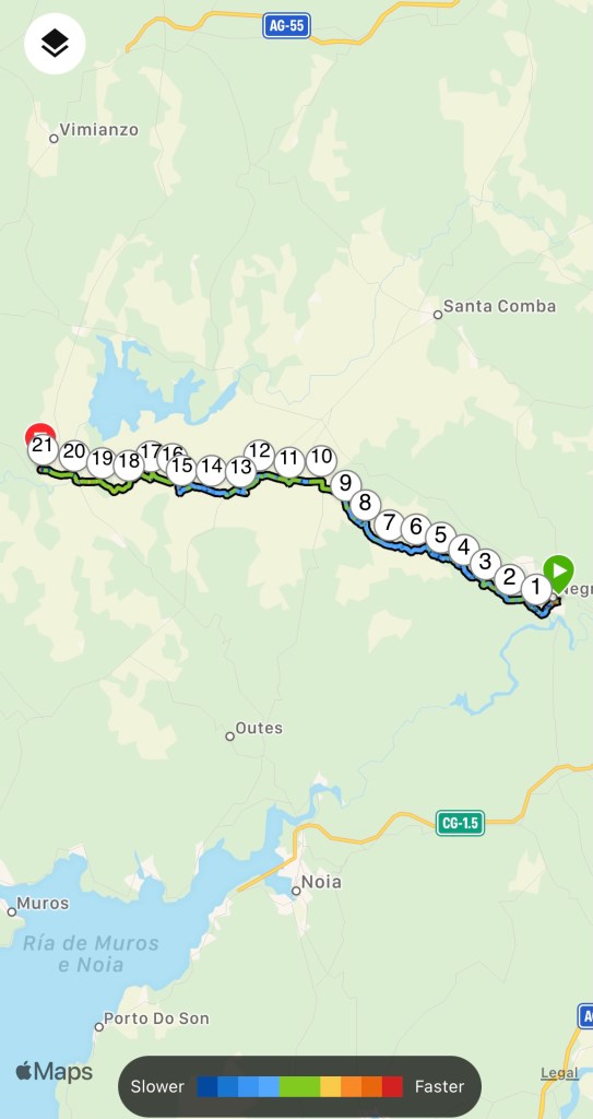
I took the short cut. I arrived at the BnB at 1820hrs. 22 miles I covered today. Not bad considering I had little sleep from the wind and owls hooting all last night.

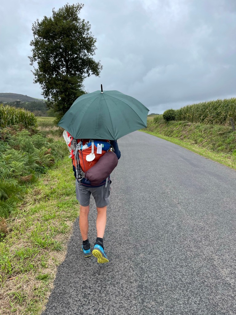
The many hills today slowed me down. Tomorrow it is forecasted for rain and if I’ve calculated it correctly, it’s another 22 miler! Poncho time.

Hailes

I set off at 0830hrs into the crisp sunshine; not a cloud in sight. It was straight up hill from the get go to reach the summit of Dover’s Hill. I was presented with views across the Cotswolds.

From here it remained relatively flat, crossing farmland and through small copses before reaching Broadway Tower. From this vantage point you can see the village nestling below.

The descent was quite quick into the village where I stopped at a picnic bench for a short brake. It was 1100hrs and I had done 6 miles; too early for lunch.

Leaving Broadway, the trail went up a long drawn out incline for 3 miles which was quite exhausting; the head wind didn’t help. As soon as it levelled out, it steeply descended into Stanton where I stopped at the Mount Inn for some food and a cold class of orange and lemonade.

From here the route passes through fields scattered by oak trees. The quintessential Cotswold landscape. I even spied a deer grazing, but it was too far for my phone to pick out.

I passed through Stanway with its stately home and grand gatehouse in a blink of an eye. Crossing the main road into Stanway Wood, marking the start of the last hill for the day. This was a steep ascent that was gruelling. My knee started give me a bit of bother which slowed my pace.

By 1600hrs I reached my campsite at Hailes, pitched my tent in the wind and settled in. Unfortunately at 1900hrs it began to rain. Not what my weather app predicted!

Still it was good to get walking again. At times my mind drifted to memories of my Camino. I felt back in my element.

Chipping Campden

Catching the Train

I’ve arrived in Chipping Campden ready to start the Cotswold Way in the morning. The weather had been clear skies and sunshine until I hopped off the bus.

Getting here was easier than I thought. Three trains that were all on time to reach Stratford upon Avon, then a bus to Chipping Campden. The only hitch was the bus stop was closed due to a closure, but there was no signage to indicate this. If it wasn’t for a local resident telling the now long queue about this, I would probably have had to spend the first night in Stratford!

I booked into my BnB which sits right on the route. I dumped my bag and had a walk around up to the start point of the trek. I was hoping for a plaque or sign to get a selfie with, but there isn’t. The route according to the map starts at the church.

Just round the corner from here is a little pub called the ‘Eight Bells’. I called in and reserved a table for food and settled in with a drink as it started to rain outside.

The forecast is winds tomorrow; that should be fun for pitching my tent up. Just hope it’s a tail wind to help me on my first long day of walking since the Camino.

Cotswold Way

Daventry Country Park

It’s been almost 5 months since I returned from the Camino de Santiago and I’m itching to get walking on another adventure; my strolls around the local country park and area have not been sating my thirst for the outdoors and my planned Camino Portugues in August is too far away for me to wait.

Once again I’m back on YouTube watching trekking videos. Two have caught my eye; Hadrian’s Wall and the Cotswold Way. Hadrians Wall was a consideration for my Prostate Cancer UK charity walk back in 2020, but the Cotswold Way will be easier for me to get to and from.

According to the Cicerone guide, the 102 mile trek is usually done over 13 stages. However, I only have one week leave from work; so I’m going to attempt to cover that distance in 5 days. I’ll be starting in Chipping Campden on the 9th March and arriving in Bath on the 13th.

It will be a mixture of camping and BnB due to the lack of campsites at the stage ends I plan to stop at and Judging by the recent weather, it maybe on the chilly and wet side! The equipment I took on the WHW will likely cut it for the March climate, however, I feel I would benefit from getting a sleeping mat suited for colder weather.

Through my obsession of gear review videos I’ve learnt that getting a warm sleeping bag is only half the job. The insulation doesn’t work if compressed; you can have the best, all singing and dancing sleeping bag in the world, but it will not stop the cold seeping in from the ground where it is squished by your body.

Not to get too technical, but the efficiency of a sleeping mat is measured by the “R” value. The higher it is, the warmer it is. Off the back of my WHW adventure, I looked into sleeping mats, as the inflatable one I took has a low rating that resulted in a couple of cold nights.

A cheap option is to buy a foam mat with a good R value and use my current inflatable one on top of that. This can save a lot of money, as you’re looking at over £100 for a decent inflatable one.

I picked up a folding mat in a sale a year ago, but it’s still very bulky; I keep eyeing it up and I can’t bring myself to lug it around on a thru hike. I hit the internet in search of a 3+ season inflatable mats.

I’ve settled on the Exped Synmat 7. It’s a bit on the heavier side at 855g, but the lighter ones are weightier on the wallet. I had a few gift cards from Christmas that I put to good use in this purchase.

Exped Synmat 7

The route starts in Chipping Campden, an important market town for the wool trade in the 17th century. I’ll be making my way there by bus and stopping a night before setting off in the morning. My journey will pass many battle sites from the English civil war, ancient Roman settlements, quaint villages before arriving in the historic spa town of Bath, where the route terminates at the abbey.

I’ll be swapping the yellow arrows that guided me across Spain, for acorns that mark the route through the Cotswolds. Fingers crossed the weather will be kind to me!

Once a Pilgrim, Forever a Pilgrim

It has been six weeks since I left Santiago de Compostela to return home and to the real world. The transition from the Camino life to “normality” has been a journey in itself. I have the constant urge to walk, both mentally and physically. My legs have been seizing up if I sit for too long. The 30 min drive to work has me exiting the car like an 80 year old; I recently drove up north to visit family and after an hour, my legs were in pain!

I’m still decompressing from the whole trip. It is such an intense journey, you can’t process the experiences while you’re walking it. You just have to live in the moment and accept everything as it comes. Now that I am home, I am getting the time to mull over the pilgrimage and let it sink in. It is said the Camino doesn’t end at Santiago but continues throughout your life; I feel this is true. The lessons I’ve learnt along the way will stick with me forever and the memories I’ve made, make me smile.

As I go about my day, I find that something will spark a memory of a particular moment during my Camino; this gives me time to pause and reminisce about my magical journey. The friends I made will always be in my thoughts and as is the way of the Camino, I’m sure our paths will cross again in the future. In fact, we have had a few zoom meetings since returning to catch up! The Whatsapp group I had set up back at the beginning of the trip, is buzzing practically on a daily basis.

Before going into this adventure, I was a little concerned that at the end I would get the ‘Camino Blues’, but so far I haven’t experienced them. I don’t feel sad that it is over, as like I said, the Camino doesn’t end in Santiago. Don’t get me wrong, I miss my Camino Family, the pilgrim community, the structure of the daily life, the solace of the walk and the ‘Tortilla y Patata’! Every time I think back on my Camino, it is fondly and there are no “blues”.

This now begs the question “What’s next?”

My sights have settled on the ‘Camino Portugues’; another pilgrimage to Santiago but starting in Porto, Portugal. This is a shorter route compared to the Camino Frances, that can be done in 10 days; according to the guide book by Harms, Dintaman and Landis.

There are two routes from Porto you can take; the Coastal or the traditional Central route. I’ve chosen the Central route as there is a mountain to climb, Alto de Portela Grande; I like a good hill to summit!

The Camino Portugues is the second most popular route next to the Camino Frances, and likely as people become more confident venturing abroad, I expect it to be quite busy next year; but this doesn’t deter me, just means there are more pilgrims to meet! It is the people you meet along the way that make the journey so special.

I’ve booked leave in August thus I will be sure to pack the sunscreen! I aim to blog this trip like the Camino Frances, so stay tuned! Till the next time, Buen Camino!

The Journey End

We left Fisterra behind by taxi passing by pilgrims entering the town. I felt as if I should still be walking.

It is an hour by car journey back to Santiago, a distance that took me 4 days to cover. Watching the countryside fly past in a blur that crawled by the last week, emphasised how slow paced life is on the Camino.

We dropped Sandra off at the airport before me and Marcus returned to Santiago; we said our goodbyes. It was like leaving a close family member.

Once in Santiago we milled around watching the pilgrims arrive at the cathedral, just taking in the atmosphere. Hard to believe that was me 1 week ago! I felt like a loose end, I should be walking.

Tomorrow I catch my flight back to blighty where the real world beckons. I’m going to have to start planning my next adventure.

Camino Francés Day 38 – Muxia to Fisterra

It was going to be a long day and there was a lot of ground to cover. We set off in the dark at 6.30am. For the first hour or so it was a constant climb into the woods; headtorches were required.

There is only one village to stop at between Muxia and Fisterra, Lires. This was 15km and it was a long 15km till breakfast.

From Lires it was undulating passing sleepy little hamlets with the coast to our right; A little slice of heaven. The sun was out and no clouds in sight.

As we approached Fisterra, our bodies were telling us we had been walking for 35 days. Our muscles were tired and our legs hurt. The last 4km was the most difficult on the journey.

You see Fisterra in front but the route takes you up and away, bringing you down into the town from the top. We stopped for a drink in Fisterra before the last 2km to the end of the peninsula.

Of course it was up hill! We finally made it to the end of the world. A big moment. There was even a bar at the end of the world! So we had a drink toasting to the end of the world and the end of the journey.

We returned to Fisterra to book into the hotel. At sunset we walked to the beach to paddle in the Atlantic and bring closure the this incredible journey.

Camino Francés Day 37 – Olveiroa to Muxia

Last night the rain was relentless and didn’t stop until the early hours. I was having flash backs to the West Highland Way! The forecast predicted it to continue raining in the morning so we planned to leave at 8am once the sun had risen.

Today the route was undulating especially the last 10km or so. The path was mainly through woodlands with only small sections on the road.

We came to the fork in the road, one way to Fisterra, the other to Muxia. We planned to do Muxia then tomorrow to Fisterra. Both are by the coast, but Fisterra is the true end. Muxia had really been made more popular due to the film.

As we reached Dumbria it started to rain on and off until about 1pm when the sun came out and remained.

One thing you notice after spending so much time in the clean fresh air, your sense of smell becomes more acute. This was emphasised at 4km from the coast, I could smell the sea air!

The route brings you to the coast but you have a further 6km to walk to get to the peninsula where Muxia sits. I arrived about 5.30. I took some pictures before booking into the albergue, then returning at sunset.

After spending 5 weeks with me, I think Marcus has had enough!

Tomorrow will be the last day of walking.

Camino Francés Day 36 – Negreira to Olveiroa

It had rained during the night so it was misty again. The route climbs out of Negreira through woodland paths. Soon we were above the mist and greeted with a scenic picture of the lights of the town below.

It was a steady climb for most of the first 10km where we stopped for breakfast. The weather was very changeable, however my newly purchased umbrella in Santiago, kept the rain off me.

At 20km we had lunch in Santa Marina with Christina from Italy. We had met the night before arriving into Santiago; she was stopping here however. After a couple of beers we set off for the last stretch.

We had one more hill to conquer before the descent into Olveiroa. We were racing the rain again, as it was forecasted for heavy downpours at 6pm.

When 6pm arrived, it very much kept to the forecast. By the time we reached the albergue, we were very soggy pilgrims.

Camino Francés Day 35 – Santiago de Compostela to Negreira

Although the pilgrimage is to Santiago which is the end for many. The true finish point is the end of the world, the Atlantic Ocean.

This will be my destination. Reluctantly I got out of bed at 7.30am, regretting going to the discotheque the night before and rocking up at the hotel in the early hours.

The route leaving Santiago is far more scenic than arriving. It passed the ruins of a mill, no industrial areas and a lot more greenery.

The constant rain from the day before had subsided leaving a mist that clung to the shallow valley out of Santiago. With the sunrising and the silhouette of the cathedral spires in the distance, it made for a stunning view.

It was easy going until around the 12km point when there was a long steep section. The walking poles came out to ease the burden on my left leg, that still was complaining.

Once past this section it was pretty much down hill all way into Negreira. In short an easy day to get back into the walking mode.