EBC Day 2 – 19th October 2009

I woke around 2300hrs to visit the rest room; seems the copious litres of water I had drunk during the day hadn’t finished with me. The paracetamol I took before bed hadn’t worked and my headache had intensified; so I popped an ibuprofen and went back to sleep. The next thing I knew it was 0600hrs, no headache and I felt refreshed!

There are no showering facilities nor hot water (as this requires a wood stove is to be burning). This meant we had to use a technique that is known as a ‘Whores Bath’ (or a ‘Corby Wash’ for those readers from Northamptonshire!) This involves using baby wipes to clean your armpits and groin region. (We brought a supply of baby wipes with us, thanks to my research for the trip)

We met the group for breakfast of porridge and black tea. One of the quirks of trekking in such a remote region of the world, is not having access to products we take for granted back home. Anything that has a short shelf life, like milk, is almost none existent. Everything has to be transported by the Sherpas on foot, which you can imagine is a slow process. There are no motorized vehicles here.

The further into the Himalayas you go, the rarer items become (and the more expensive), especially luxury items such as milk. However, you soon get used to drinking black tea and even to this day, I prefer tea without milk.

The Shire

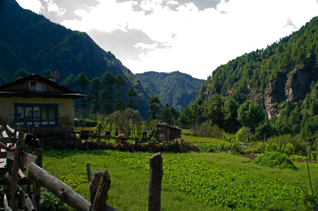
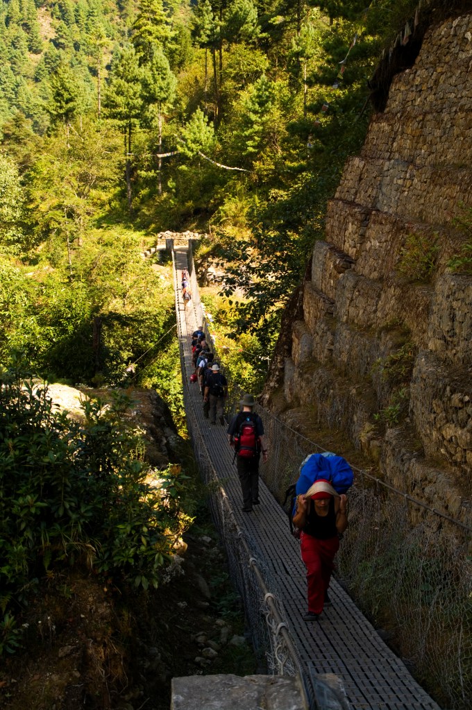
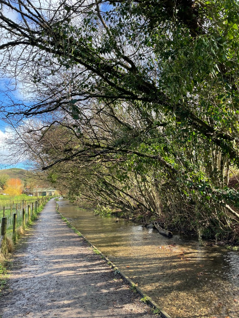
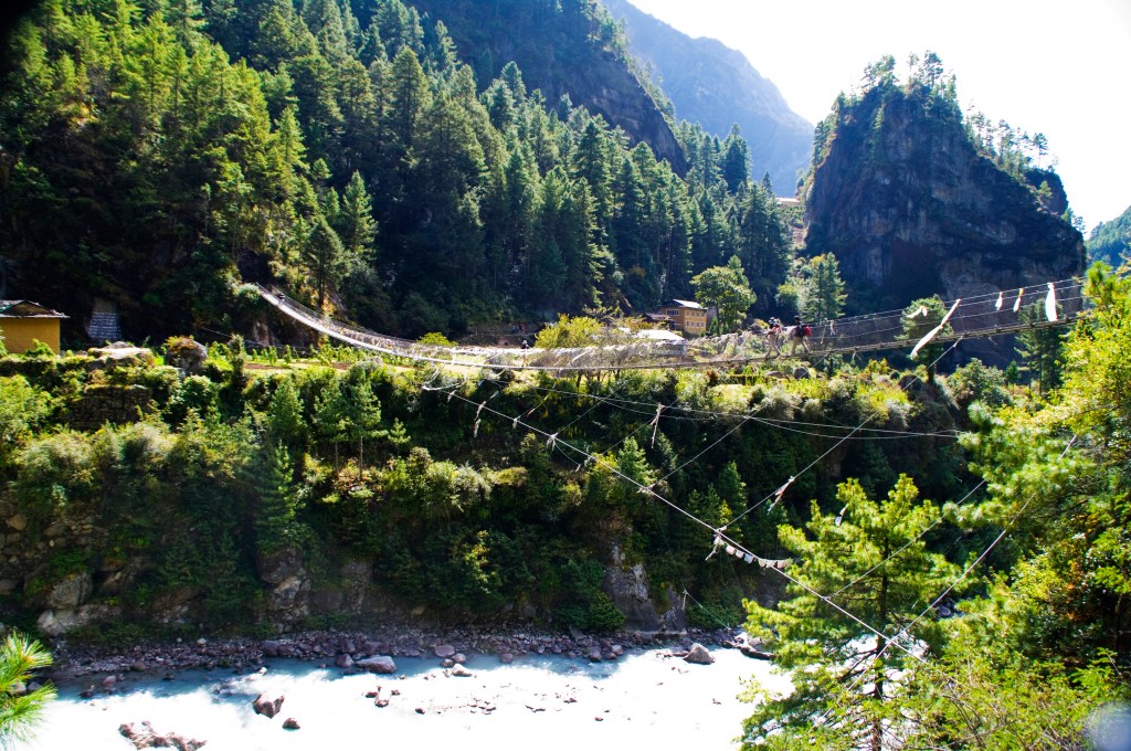
Once fueled up, Rajesh shouted “Djam Djam” (Nepalese for let’s go or move) which is the signal for us to get walking. Leaving Prakding the incline was gentle, traversing more suspension bridges that crisscrossed the river, passing smallholdings with gardens full of green vegetables; I joked with Pete that we are in the shire from ‘The Lord of the Rings’ books.

Tea Break

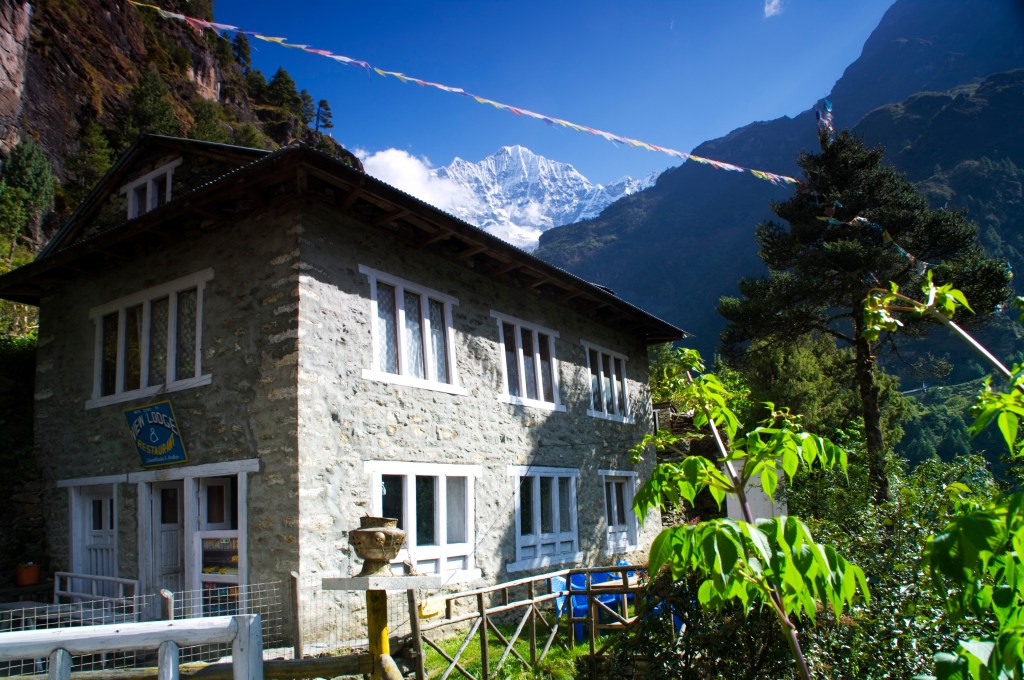
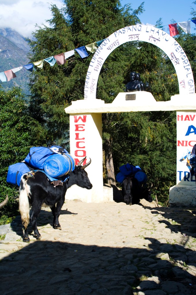
The path came alongside a waterfall and a small teahouse, overlooked by a snow capped peak. We stopped here for a lemon tea break and a snack. At the shout of ‘Djam Djam’ we continued onwards to the manned entrance to the Sagarmatha National Park (Sagarmatha is the Sherpa name for Everest).

We had to get a photographed permit at the office before we could continue. As part of the equipment and documentation requirements given to us by the travel company, we already had our passport photographs. I now have the permit displayed on a book shelf in my living room.

Sagarmatha National Park

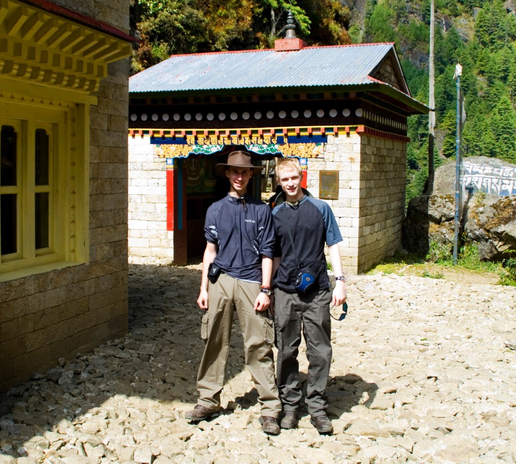
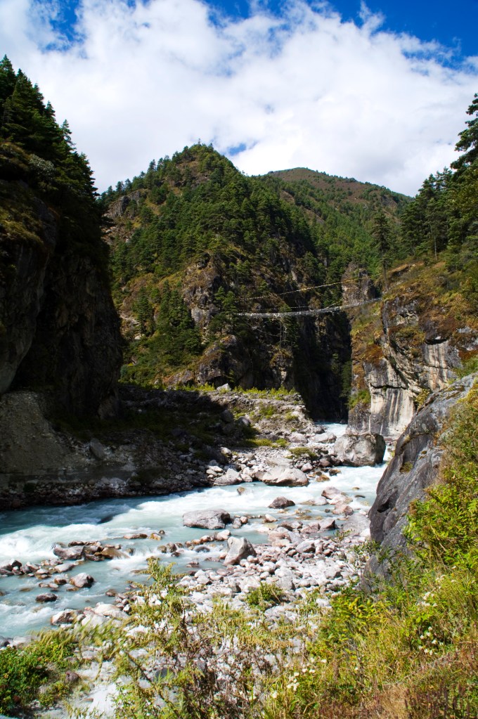
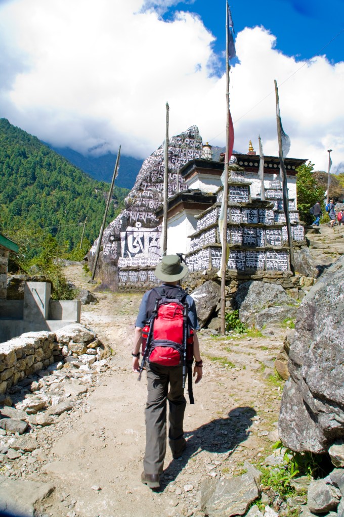
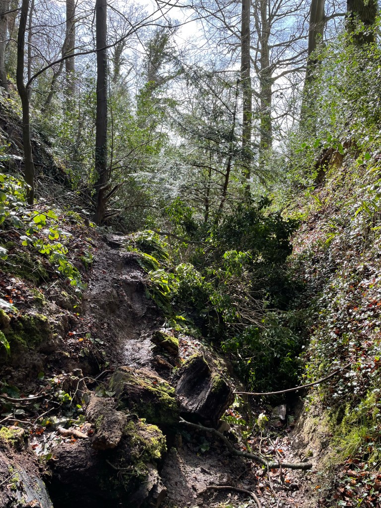
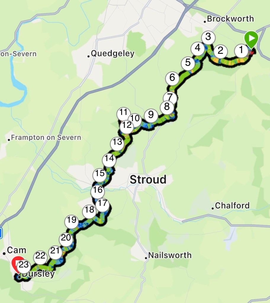
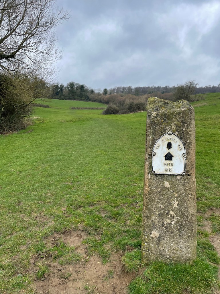
The group passed through the brick built gatehouse into the national park, continuing along the footpath, still with the gentle incline. This abruptly ended at a suspension bridge that crossed the river, to what looked like a huge, treed rockface. From here the route became fiercely steep, zigzagging it’s way to the Sherpa capitol, Namche Bazaar.

Once we crossed the bridge, two Sherpas and a man on horseback were heading down. The chap on the horse didn’t seem very well, he was pale and had a dazed/vacant look. Turns out he had altitude sickness and was being taken to lower climes, to recover in the Oxygen rich lowlands.

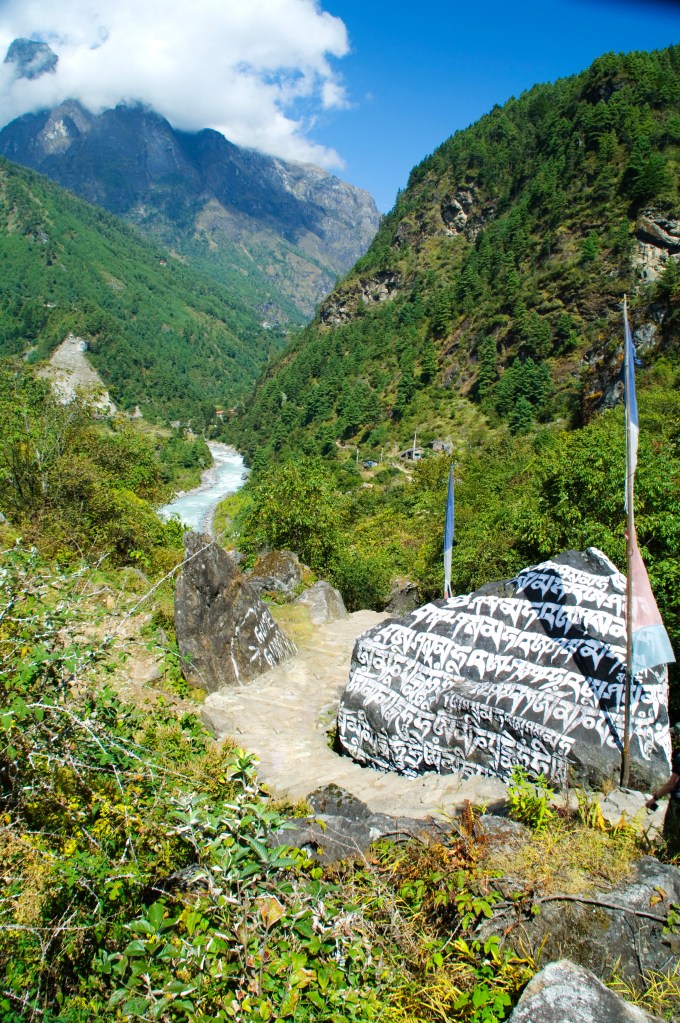
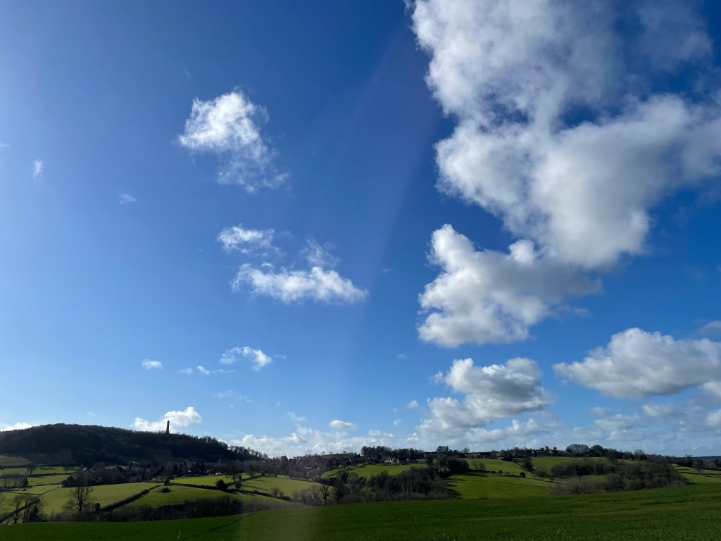
It was tough going as we snaked up the track, dodging yak trains and Sherpas who were practically running past us. We got to a view point and through a clearing in the trees, we got our first view of Sagarmatha herself. Unfortunately Everest’s peak was obscured by clouds and we only got brief glimpses through small gaps.

I couldn’t help but smile seeing our destination in the distance, I just hoped that it would be cloudless when we climb Kala Patthar, to get those infamous views of the tallest mountain in the world.

Namche Bazaar

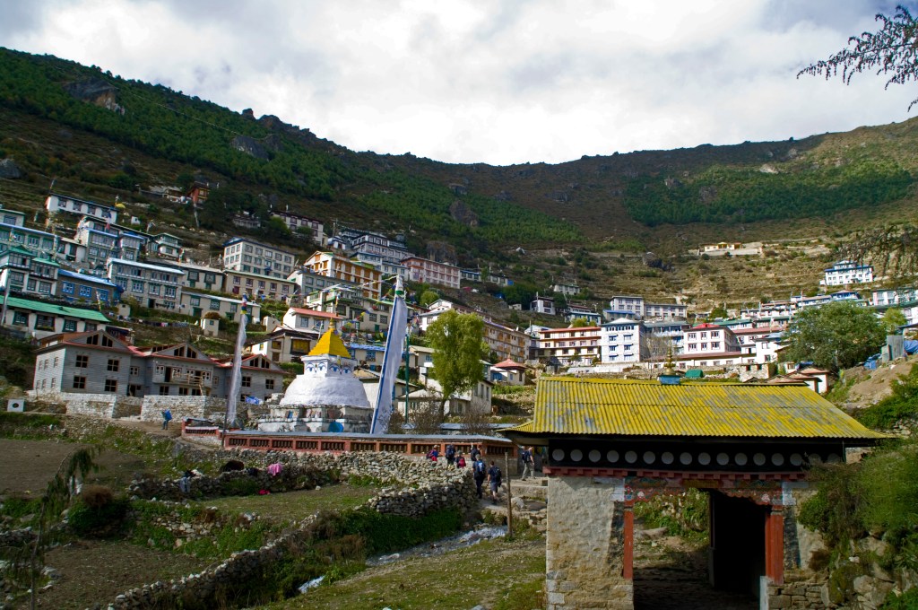
Late afternoon we arrived at Namche Bazaar. A brightly coloured jewel clinging to the mountain side in a horseshoe shape. We were guided through the narrow, winding streets to our teahouse and home for the next two nights. (Thankfully they had hot water and showers)

Outside there is a patio giving views down the valley we had just ascended. After sorting out our gear, we sat on the patio watching the clouds move in from the valley below. They rolled in like a tide with surprising speed until they enveloped the Sherpa Capitol.

Pete needed some trainers, so we hit the markets and stalls. We had a browse at what was on offer and after treating ourselves to a Mars bar each, we met up with Andre and Nick from our group in a teahouse; soon the rest of the group joined us.

Pete and I, along with two members of the group, Colin and Linda, headed back to the shops. Colin works in sales and used his bartering skills to get a pair of trainers that were 2500 rupees for 1500 rupees! He was so slick at it, expertly using humour to haggle down the price; it was like watching an artist at work!

Pete was over the moon with them, although Nike knock offs, if you ask him, he will say those were the best pair of trainers he has ever owned! We continued browsing as Colin was hunting for a hideous looking item of clothing for a game he wanted to play with the group.

It was called “Dick of the Day”. The idea being, if someone had done something silly or noteworthy, they are nominated to a chosen committee. If it is approved, as a forfeit they would have to wear this item the following day.

After searching almost all the shops in Namche Bazaar, Colin found the ideal item. A fur lined, blue Tibetan style jacket with a floral pattern. At dinner, the game was announced and the first winner was Nick! We all retired for the evening and so far my headache hadn’t returned; long may that last!

Bridge to the Treed Rockface

EBC Day 1 – 18th October 2009

Plane Landing at Lukla Airport

The previous day had been exhausting travelling from blighty, arriving at the hotel in in the evening at Kathmandu. After we had the meet and greet with our guide Rajesh, we headed into town to get something to eat and to transfer some currency into Nepalese Rupee. The streets were alive with celebration and fireworks for Diwali, resulting in a late one.

It was difficult forcing myself out of bed at 0400hrs to get ready to catch the coach to the airport at 0515hrs. This was made even harder due to the lights in the bathroom not working, thus we had to do business by torch light. To top it off there was no hot water, so I skipped my morning shower that I rely on to wake me up!

The short coach ride to the airport passed through the now quiet and empty streets that were full of life the night before. From the airport in the dawn light, we could see the Himalayas in the distance causing a little wave of giddiness to pass over me. The adventure is about to begin! We left the terminal and crossed the tarmac to a tiny twin propeller plane, squeezing through a tiny hatch to the cabin, where we were packed in like sardines.

The two pilots, in brown leather flight jackets with white woolen collars, complete with aviator glasses were all set in the cockpit. It was like something from Indiana Jones and the Temple of Doom!

The flight to Lukla resembled a rollercoaster. The plane would bank left and right, zipping between the towering peaks of the Himalayas. Just before we came into land, the pilot reached up and grabbed the throttle and with a swift motion, pulls on it as the plane dives into it’s approach to Lukla.

The peculiar thing about this airport is the runway; nestled on a cliff face, it has an upward gradient ending in the side of a mountain, however the most striking feature though, is the runway, it is very, very short! If the plane were to overshoot on landing, it would crash into the mountain and if the plane doesn’t build enough speed on take off, it will fall off the mountain!

As we disembarked the plane, I was stunned by the scenery; I was amongst giants! I had finally set foot in the Himalayas. Lush green mountains, blue skies and fresh cool mountain air. The adrenaline was surging through my veins.

Our group stopped at a teahouse to get a hot drink and sort our luggage out. Moving items to our day packs from our main bags. Here we met the remainder of our guides and the Sherpas who would be carrying the bulk of our belongings.

We set off following a mountain path, passing through a welcoming arch where we met our first yak train. All the while we were being overtaken by Sherpas carrying items in baskets strapped to their heads with sandals for footwear; they really put me to shame. There was one snow capped mountain that dominated the skyline for most of the day. ‘Karyolung’ with a summit of 6511 metres above sea level. EBC sits 1200m below that, putting into perspective how high I would be reaching.

We took our time following the path at the advice of our head guide Rajesh. To avoid altitude sickness, we were to walk slowly and drink plenty of water. As a result, we made plenty of stops for the toilet! The route crossed suspension bridges over rivers and valleys. It would snake around huge painted boulders and shrines, under lines of prayer flags flapping in the mountain breezes.

We eventually reached our teahouse for the night at Prakding (2610m). It was very basic, which is common of the lodgings along the trek. Two single wooden beds made up each room, with mattresses that might as well have been a sheet of cardboard.

We had a light meal of noodle soup before having a siesta, after which we had an explore of this little hamlet. We met up with more of our group at a teahouse and chatted over a cup of lemon tea. We returned for our evening meal of chicken and chips; I would have had the Yak but they had ran out!

We got to know our group a little more over a few card games. Night had arrived and so began the Diwali celebrations. We ventured out again to watch the festivities before retiring for the night. I lay in bed feeling very weary from the flights, lack of sleep and the day’s walking. I had a mild headache since dinner and I hoped it would go in the night and not a sign of altitude sickness.

Pete Admiring the Shrine

Where it All Began

Like most good ideas, this one started in a pub. This particular pub was ‘The Old Nags Head’ in Edale within the Peak District. Myself and my good friend Barry had spent a very wet and miserable morning walking the hills around Edale, on a Saturday in Early spring 2008.

As we sat drinking our pints, Barry told me about a colleague who had recently attempted to walk to Everest Base Camp (EBC), however he came down with altitude sickness and was unable to make it to the end point. My response to this was “Soft” and that we could do it.

We were both 24 at the time; Barry had always been a fitness enthusiast and I was doing morning circuit training with an ex-army PT instructor twice a week. Everest Base Camp was as good as done! So we put our money where our mouths were and started to plan.

After some research, we determined the best time to go would be autumn or spring, so we chose Autumn 2009, to give us more time to train and save up for it. We found a travel company that specialised in these types of trips and booked through them.

There were two options we could take: the standard EBC route or the more challenging route to EBC via the Gokyo Lakes. Naturally, to prove how hard we are, we picked the latter. We managed to rope another friend Pete into the endeavor and after a prolonged nagging campaign, I also convinced my brother, also called Pete, to join us.

Over the year we continued training and did some walks in Snowdonia to prepare us for the Himalayas. However as the date approached Pete dropped out and Barry wanted a career change and was due to start teacher training in September 2009. That left me and my brother.

Barry instead took the normal EBC route in spring 2009. He came back a little broken after suffering a stomach bug throughout most of the trek; he did make EBC though. This didn’t sit well, as it dawned on me, that this could be harder than I anticipated. However hearing from his experience and what he had learnt, bolstered my excitement for it and allowed me to refine my gear choice.

At the time I was in a minimum wage job and Pete was still at university, resulting in us equipping ourselves on a budget. The two things we splashed out on, were a warm sleeping bag and footwear. I got some Brasher walking boots, that lasted me years and had been by far the best pair of boots I’ve ever owned. It was a sad, sad day when they gave up the ghost while climbing Barrow in the Lake district.

Red = Route to EBC : Green = Return Route

The route we took starts at Lukla, the location of the most dangerous airport in the world. From here to the Sherpa capitol, ‘Namche Bazaar’; where we took a rest day to aclimatise to the altitude before moving on to the the Gokyo Lakes, to climb the mountain ‘Gokyo Ri’.

There are two glaciers in the region that we followed; ‘Ngozumba Glacier’ where you will find the Gokyo Lakes and the more famous, ‘Khumbu Glacier’ where EBC sits. The two glaciers are separated by the huge peaks, one of which is the towering ‘Cholatse’ at 6,440m. To get between them, you cross the ‘Cho La Pass’.

Once we conquered Cho La Pass we made our way to ‘Gorak Shep’. the last village before EBC. We would then go to EBC before climbing ‘Kala Patthar’; we then descended to ‘Tengboche’ before returning to Lukla.

In a nutshell, that is the background to my adventure in the Himalayas, between the 16th October 2009 to 6th November 2009. The start of my love affair with travelling and long distance hikes.

Retrospective Blogs

I had an idea of writing a blog about my Everest Base Camp and Kilimanjaro adventures I did some years ago.

For both of these trips, I kept a travel journal to document these amazing experiences and I plan to use it in this series of blogs.

In the next few days, I will be doing some alterations to my site and start releasing a post a little more often, in the lull between my current adventures.

Keep an eye out for them and I hope you will enjoy reading about my jaunt in the Himalayas and Tanzania.

Bath

Today has been a good day on the way, despite the claggy mud. The weather held out and didn’t rain until 1700ish, giving me almost two hours spare.

I fuelled up with an omelette for breakfast before hitting the trail at 0830hrs. The route went to Tormarton and over the M4 before cutting across farmland.

More Storm Damage

It remained flat until 10 miles in, where the route dipped down into a valley and back up. There was a message box halfway up a steep section. I paused to have a read and add my own; it gave me an excuse to have a rest.

Once out of the valley I arrived at the site of the Battle of Lansdown. Where Sir William Waller for the parliamentary fought against Sir Ralph Hopton for the Royalists. They were childhood friends but ended on opposite sides of the war.

As I was making my way around the empty field, I met a walking group who were being led by two volunteers for the Cotswold Way Association. They spied my backpack and stopped for a chat. Apparently I can upload a picture of me at the abbey on their website’s “hall of fame” for completing the whole way.

It remained level from here until I skirted around Bath racecourse where I got my first glimpse of the end point. Still two hours of walk ahead of me; I pressed on.

I still had one more hill to tackle before the finish line; Primrose Hill. This sits between Weston and Bath. After cresting this it was a leisurely descent to the finish line.

Outside the abbey it was very crowded so I couldn’t get to the end point plaque; I returned later once the rain had chased everyone away.

Inside the abbey, it reminded me of Leon cathedral, with the high ceilings and stained glass windows. After a walk around Bath, I got some food and retired to my hotel to rest my weary legs.

Old Sodbury

The word of the day is ‘mud’. Yesterday’s rain has caused the paths to form a claggy muddy mess. Each step caused my foot to slide, then it would stick to my boots! Several times I almost did the stranded turtle pose!

As I wouldn’t be camping for the rest of the trip and to lighten the load enabling me to pick up the pace, I sent my tent and sleeping bag back home. Only snag was the post office didn’t open until 0900hrs. By the time I got it all sorted it had gone 0930hrs.

The late start and the mud underfoot slowed me down, however the uphills where now easier! Straight out of Dursley the ascent was devilish. Already offloading the tent had paid off.

The path then went immediately downhill into North Nibly with its huge monument looking over the village. I just knew I would be climbing up to it, and I was correct!

After the steep incline I got to the top where I was presented with panoramic views and the river Severn in the distance; I could even see the white towers of the ‘Severn Bridge’!

If you Zoom in you can see the Severn Bridge

I then descended into Wotton under Edge just as I had the first and only rain shower of the day. Other than that it remained sunny. A stark difference from the day before; I put my umbrella to good use.

Coming out of Wotton was my third steep incline; that’s three in 6 miles! I got chatting to a fellow walker following the route northwards. Thankfully he said it’s mostly downhill into Bath.

Leaving Wotton

As it is Saturday, there were plenty of people out enjoying the good weather. Seeing me with my big backpack peaked their interest and I stopped to chat with them. It was great to have a friendly chat to spur me on.

From here on it undulated but no more big climbs. As I descended into Wortley the path followed a narrow muddy ravine that was blocked by a fallen tree; another casualty from the storms.

After a bit of a muddy scramble I circumnavigated it before reaching Wortley and Alderley where I stopped to eat my sandwiches.

I continued on into Hawksbury Upton where there was a field of lambs chasing each other. I paused to take in the moment before plodding on. It wasn’t long before I entered Little Sudbury where two lovely elderly ladies walking their dogs spotted my backpack.

I’m glad I stopped to chat with them as they gave me an alternative route to my BnB that avoided walking along a busy ‘A’ road; a bit of Cotswold magic?!

Despite starting very late I arrived just after 1630hrs. It had been a good day on the way, only one more to go. Tomorrow Bath.

Dursley

Today was easier but only just despite the rain. I set off about 0730hrs to get 30mins walk in before the rain was predicted to set in. Most of the trek today was in woodland thus little picture opportunities. However I have crossed over the halfway mark!

The route immediately went down hill to my heart’s discontent. One thing I have learnt quickly, is on the Cotswold Way every decline is followed by steep inclines.

I passed trees with yellow arrows painted on them; a sign of the Camino! I took this as a good omen.

Once I reached the bottom of the woodland it was level for 3 miles until the first short, but fierce incline of the day to summit Cooper’s Hill. As I reached it the rain arrived. I was lucky to get an hour walk in the dry.

From here I had one other climb over Buckholt nature reserve before arriving into Painswick. I called into the local shop to buy a sandwich and snacks for the day.

I had lost sight of the way markers and got a little lost in the village before I grabbed my map and found the route again.

Painswick Church

From Painswick, the path went down hill fast which only means an uphill is on its way, and it was there in front of me, taunting me. Once I reached the crest it was a gentle decline through woodland before reaching a country road.

I followed the road down about 1/4 of a mile before the path turned off and up a hill. But as I reached this, the forestry committee had blocked it off. Apparently due to the storms we had two weeks earlier had made this part unsafe.

The diversion was back up the road which eventually joined the Cotswold Way on the other side of the blocked off section. It was also a longer!

I eventually descended into Ryeford passing a vineyard (another reminder of the Camino) and crossing a canal, before I hit two very steep hills to reach Coaley Peak. Here I got my first look at Dursley in the distance.

Sorry Looking Vineyard

I followed the ridge line of the hill before the descent into Dursley. At 1700hrs the sun had decided to show itself giving a pleasant stroll to the end of the day.

Today was harder on my feet as the terrain was hard under foot or very slippy cobble like stones that were wet and muddy. Hopefully tomorrow will be drier!

Birdlip

Well today didn’t stick to the script. It felt like it has been up hill for 22 miles; of course it wasn’t, but it certainly felt like it. I certainly found it tough today.

I left the campsite just before 0900 and covered the 2 miles to Winchcombe in no time, passing the ruins of Hailes abbey. I called into a newsagent for a meal deal as there are no villages between Winchcombe and Birdlip.

Abbey Ruins

I made my way back on the Cotswold Way, starting the incline up to Belas Knap Long Barrow. I got chatting to a couple who had done the Camino!

From the barrow the route cut across farmland before descending through woodland to Postlip. the small hamlet dominated by Postlip Hall.

Postlip Hall

From here it was an ascent to Cleeve Hill with a head wind. I stopped just before the summit for lunch before continuing. The way follows the edge of the hill range, winding around crags and sharp drops. The path skirts south of Cheltenham, giving lofty views of the city and the racecourse.

Cheltenham racecourse

Soon I hit a descent before again climbing another steep hill, this one too snaking around the edge, eventually overlooking Gloucester. At this point the light was fading and I still had some distance to cover.

Gloucester

After making my way down I reached Ullenwood. It was 1720hrs at this point and the route took a right through the village. I was really flagging and I sat on a grit box at the side of the road to assess my options.

If I followed the Cotswold Way it ascended another hill or two, continued to snake around the edges before reaching Birdlip; another 4-5 miles at least.

However Google maps showed I was 1.8 miles away from my destination. But meant I would have to follow an ‘A’ road; unless I cut across a woodland park, involving short but steep hill!

It would then join a country road into Birdlip. My options were follow the route, take the short cut or get a taxi; the taxi was very tempting.

I took the short cut. I arrived at the BnB at 1820hrs. 22 miles I covered today. Not bad considering I had little sleep from the wind and owls hooting all last night.

The many hills today slowed me down. Tomorrow it is forecasted for rain and if I’ve calculated it correctly, it’s another 22 miler! Poncho time.

Hailes

I set off at 0830hrs into the crisp sunshine; not a cloud in sight. It was straight up hill from the get go to reach the summit of Dover’s Hill. I was presented with views across the Cotswolds.

From here it remained relatively flat, crossing farmland and through small copses before reaching Broadway Tower. From this vantage point you can see the village nestling below.

The descent was quite quick into the village where I stopped at a picnic bench for a short brake. It was 1100hrs and I had done 6 miles; too early for lunch.

Leaving Broadway, the trail went up a long drawn out incline for 3 miles which was quite exhausting; the head wind didn’t help. As soon as it levelled out, it steeply descended into Stanton where I stopped at the Mount Inn for some food and a cold class of orange and lemonade.

From here the route passes through fields scattered by oak trees. The quintessential Cotswold landscape. I even spied a deer grazing, but it was too far for my phone to pick out.

I passed through Stanway with its stately home and grand gatehouse in a blink of an eye. Crossing the main road into Stanway Wood, marking the start of the last hill for the day. This was a steep ascent that was gruelling. My knee started give me a bit of bother which slowed my pace.

By 1600hrs I reached my campsite at Hailes, pitched my tent in the wind and settled in. Unfortunately at 1900hrs it began to rain. Not what my weather app predicted!

Still it was good to get walking again. At times my mind drifted to memories of my Camino. I felt back in my element.

Chipping Campden

Catching the Train

I’ve arrived in Chipping Campden ready to start the Cotswold Way in the morning. The weather had been clear skies and sunshine until I hopped off the bus.

Getting here was easier than I thought. Three trains that were all on time to reach Stratford upon Avon, then a bus to Chipping Campden. The only hitch was the bus stop was closed due to a closure, but there was no signage to indicate this. If it wasn’t for a local resident telling the now long queue about this, I would probably have had to spend the first night in Stratford!

I booked into my BnB which sits right on the route. I dumped my bag and had a walk around up to the start point of the trek. I was hoping for a plaque or sign to get a selfie with, but there isn’t. The route according to the map starts at the church.

Just round the corner from here is a little pub called the ‘Eight Bells’. I called in and reserved a table for food and settled in with a drink as it started to rain outside.

The forecast is winds tomorrow; that should be fun for pitching my tent up. Just hope it’s a tail wind to help me on my first long day of walking since the Camino.